Telangana Tourism, History, Art and Culture with a 360 degree view, covering anything and everything !

Showing posts with label Geography. Show all posts

Telangana Forests

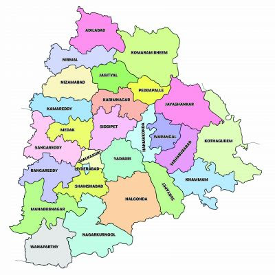
The State of Telangana is endowed with rich diversity of Flora and Fauna. The State has dense Teak forests on the northern part along the banks of river Godavari. As per the Champion & Seth Classification of Forest Types (1968), the forests in Telangana belong to three Forest Type Groups, which are further divided into 12 Forest Types.  

Teak (Tectona grandis) no longer figures in the top five tree species in Telangana. Felling of the timber tree species has increased so much that the inventory indicates that teak no longer figures among the top five species. This is revealed by the latest report ‘State of Environment Report-TS’, sponsored by the ministry of environment, forests, climate changes. The report has recently been released in the state.

Telangana State is known for its rich heritage in biological diversity distributed in 9 agro climatic regions. Among the flora, the state harbours a total of 2,800 taxa belonging to 1,051 genera under 185 families. This accounts for 16% of the Angiosperms known from India. Of these, 2,071 species belonging to 150 families and 796 genera are Dicotyledons and 729 species belonging to 255 genera and 35 families are Monocotyledons.

Among the fauna, Telangana State is rich with 108 species of mammals that include Tiger, Leopard, Sloth Bear, Giant Squirrel, Hyena, Fox, Wild Dog, Wild Boar, Indian Bison(Gaur), Spotted Deer, Barking Deer, Black Buck, Four-horned Antelope, Blue Bull, Sambar, Mouse Deer, Honey Badger, Civets,Jungle Cats, Otter, Pangolin, Bats, Tree Shrew, Common Langur,etc.

Telangana's native vegetation can be broadly categorized into three types:
  1. Tropical Deciduous forests
  2. Tropical moist deciduous forests
  3. Tropical thorn forests

Tropical Deciduous forests
Adilabad, Karimnagar, Warangal, and Khammam are home to tropical dry deciduous woods. Tree species, including teak, bamboo, tamarind, and mango, define these woodlands. During the dry season, the trees in these woods lose their leaves, covering the forest floor with a layer of dried leaves.

Tropical moist deciduous forests
Mahabubnagar, Nalgonda, and Rangareddy are areas of tropical moist deciduous woods. These forests have many different types of trees, including mango, teak, sal, bamboo, and sal. Deer, wild boar, and monkeys are just a few of the many species of fauna that call these forests home.

Tropical thorn forests
The areas around Hyderabad, Medak, and Nizamabad are home to tropical thorn forests. Acacia, Prosopis, and Butea trees distinguish these woodlands. These trees contain thorns, and thorny bushes and shrubs are all over the forest floor.

Telangana is also home to a wide range of additional plants and trees, such as palm trees, banyan trees, and eucalyptus, in addition to these three primary forms of vegetation. Various flora and animals may be found in the state's national parks and wildlife sanctuaries, including the Kinnerasani and Kawal Wildlife Sanctuary. Telangana's natural vegetation is abundant and diversified, essential to the state's ecology and economy. Numerous tree species may be found in the state's woods, including teak, bamboo, sandalwood, and other floral plants, shrubs, and herbs.

The State Government has taken up a massive greening programme, 'Telangana Ku Harita Haram' in the State to plant and protect 230 crore seedlings over a period of 4 years. This initiative aims at achieving the twin objectives of increasing the forest cover and reduce pressure on the existing forest resources, through massive community participation by Vana Samrakshna Samithis (VSS) and Eco-Development Committees (EDCs) in Protected Areas and Watershed Development Committees in the Watershed areas.

Recorded Forest Area (RFA) in the State is 26,904 sq km which is 24.00% of its geographical area, of which 20,353 sq km is Reserved Forest, 5,939 sq km is Protected Forest and 612 sq km is Unclassed Forests. In Telangana, during the period 1st January 2015 to 5th February 2019, a total of 9,420 hectares of forest land was diverted for non-forestry purposes

The reserved, protected and unclassed forests are 75.65%, 22.07% and 2.28% of the recorded forest area in the State respectively. However, as the digitized boundary of recorded forest area from the State covers 26,989.00 sq km,


Geographical Area : 11,231 hectares
Forests : 2,540 hectares (22.6%)
State Animal : Jinka (Chital Deer)
State Bird : Palapitta (Indian Roller)
State Flower : Tandgedu (Tanners Casia)
State Tree : Jammi Chettu (Prosopis Cineraria)
State Fruit : Mango
State Fish : Korameenu or Korramatta (Murrel Fish)

State Tree - Jammi Chettu or Prosopis Cineraria
The Jammi Chettu, also called the Prosopis Cineraria, is the state tree of Telangana. This tree is indigenous to the Indian subcontinent and tolerates the hot, dry climate there. The Jammi Chettu is a small to medium-sized tree that can withstand brutal conditions because of its vast root system and rough, greyish-brown bark. Jammi Chettu trees produce tiny, yellow-green blooms in the spring and their fluffy, light green leaves. The wood from the tree is highly prized since it can be used to build, build things, and make furniture. Various animals, including birds and insects, can find shade and shelter under the Jammi Chettu, which is significant for the area's environment.

State animal- Chital or Spotted Dear
The Spotted Deer, often called the Chital or Axis Deer, is the state animal of Telangana. Native to the Indian subcontinent, this beautiful mammal is easily identified by its characteristic white spots on its reddish-brown coat. The spotted deer's main foods are grass, leaves, and fruits. It is a gregarious creature that gathers in herds of up to 30 people. The Spotted Deer plays a significant role in Telangana's ecology by regulating specific plant species' growth, and maintaining the ecosystem's equilibrium. Deer are hunted for their meat and hide and are another well-liked game animal. The Spotted Deer has been designated as the state animal of Telangana.

Three National Parks and nine Wildlife Sanctuaries constitute the Protected Area network of the State covering 5.08% of its geographical area.

National Parks 
Wild Life Sanctuaries
Sacred groves are small patches of native vegetation traditionally been protected on the grounds of religious faith, these are dedicated to deities, protected by the local communities considering it as the abode of their ancestral deities or spirits. 

There are 65 sacred groves documented in Telangana but conservationists say the real figure is much larger and government should take up extensive documentation. In Kerala around 1,500 sacred groves have been documented.
  1. Adilabad Dankanapally Sacred Grove
  2. Adilabad Jainath Sacred Grove
  3. Adilabad Keslapur Sacred Grove
  4. Adilabad Kunthala Waterfalls Sacred Grove
  5. Adilabad Mahagoan Sacred Grove
  6. Adilabad Narnoor Sacred Grove
  7. Adilabad Pochara Falls Sacred Grove
  8. Adilabad Sadalpur Sacred Grove
  9. Adilabad Sirichelma Sacred Grove
  10. Adilabad Tangri Madra Sacred Grove
  11. Adilabad Yekantapur Sacred Grove
  12. Asifabad Ginnedhari Sacred Grove
  13. Nirmal Basara Saraswati Temple Sacred Grove
  14. Hyderabad
  15. Babasharfuddin Pahad Sacred Grove miralam tank
  16. Chiran Palace sacred Grove{Brahmananda Reddy National Park) 400 acres
  17. Guruvayur Temple Sacred Grove, 3ha
  18. Maulali Darga Sacred Grove
  19. Nowbath Pahad Sacred Grove
  20. O.U.Campus Sacred Grove – Nagadevata / Gyanalaxmi temple
  21. Karimnagar
  22. Kaleswaram Temple Sacred Grove
  23. Konda Gattu Sacred Grove
  24. Ramagiri Fort Srirama Temple Sacred Grove
  25. Vemulawada Temple Sacred Grove
  26. Khammam
  27. Parnasala Sacred Grove
  28. Nugur Fort
  29. Sthambhadri, Khammam Fort Sacred Grove
  30. Medak
  31. AlIadurg Sacred Grove
  32. Kumaravelli Sacred Grove Siddipet Mandal, temple of Mallikarjuna Swamy
  33. Mallamma Temple Sacred Groves dubbak
  34. YedupayaJa Sacred Grove - Durga Devi.
  35. Nalgonda
  36. Chandrumgutta(Arur) Sacred Grove
  37. Ethipothala Sacred Grove nagarjunakonda
  38. Narketpalli Sacred Grove - Ramalingeswara swami / Machiyagiri Laxminarayana swami
  39. Yadagirigutta Sacred Grove - Narasimha Swamy
  40. Nizamabad
  41. Vellutla Sacred Grove
  42. Rangareddy
  43. Alwal temple area Sacred Grove
  44. Ananthagiri area Sacred Grove
  45. Chilukur Balaji temple area Sacred Grove 6ha
  46. Keesaragutta bill area Sacred Grove Kusaiguda village
  47. Kharmanghat Hanuman temple Sacred Grove osmania university
  48. Maheswaram Sacred Grove
  49. Majeedpur Venkateswara Temple Sacred Grove
  50. Pahar-e-Sherief Sacred Grove
  51. Parameswar Gutta area Sacred Grove – shiva
  52. Sanghi temple complex Sacred Grove
  53. Warangal
  54. Kotilinga Kshetram Sacred Grove 11 acre Bollikunta village
  55. Madikonda Sacred Grove Kazipet
  56. Padmakshi Gutta Sacred Grove - 1 sq.km.- Padmaksharnrna
  57. Mahabubnagar
  58. Jellupenta
  59. Kadalivanam
  60. Koyalakonda area
  61. Kurumurthi Konda
  62. Maniyamkonda
  63. Saileshwaram
  64. Singavatnam
  65. Umamaheswaram
  66. Yettam
 
Plants
Total plant species 2800
Plants used in traditional medicine 1800
Rice (Vadlu) 150
Jowar (Jonnalu) 75
Bornyard millets (Odalu) 5
Italian millets (Korralu) 10
Little millets (Samalu) 7
Kodo millets (Arikelu) 10
Pearl millets (Sajjalu) 10
Proso millets (Varigelu) 2
Finger millets (Ragulu) 7
Gingelly (Nuvvulu) 15
Chickpea (Sanagalu) 8
Green Gram (Pesalu) 8
Black Gram (Minumulu) 10
Cowpea (Alasandalu) 10
Pigeon Pea (Kandulu) 15
Horse Gram (Ulavalu) 6

Animals
Annelids 163
Arthropods 1337
Molluscs 480
Freshwater fish 180
Amphibians 22
Reptiles 103
Birds 486
Mammals 108

Urban Forest Blocks Developed/In Progress
  1. Adilabad 
    • Mavala 
    • Kadam 
  2. Bhadradri Kothagudem Punukula 
    • Chatakonda 
    • Uragutta 
    • Suraram 
    • Rathamgutta 
  3. Hyderabad 
    • Jublee Hills 
  4. Jagtial 
    • Venkatraopet
    • Jagtial 
  5. Jayashankar Bhupalpally 
    • Kompally extn. 
    • Mahadevpur 
    • Jakaram-I 
  6. Kamareddy 
    • Lingareddy 
  7. Khammam 
    • Velugumatla 
    • Lankapally 
  8. Kumarambheem
    1. Asifabad Ada RF 
    2. Vempally 
  9. Mahabubabad 
    • Jammandlapally 
  10. Mahabubnagar 
    • Appannapalli 
  11. Mancherial 
    • Chennur 
    • Rally 
    • Indaram 
    • Tandur 
  12. Medak 
    • Narsapur 
    • Manoharabad 
    • Wadiaram & Polampally 
    • Parkibanda-I 
  13. Medchal Malkajigiri 
    1. Chengicherla
    2. Medpally -I & II
    3. Narepally - I & II 
    4. Dulapally 
    5. Kandlakoi 
    6. Nagaram 
    7. Yadgarpally-I & Yadagarapalli - II (UN)
    8. Dharmaram & Upperpally (UN) Cluster 
    9. Keesara 
    10. Gajularamaram, Borampet 
    11. Turkapally 
    12. Lalgadi-Malakpet 
    13. Gowdepally
    14. Pochampally Kalan & Pochampally Khurd Cluster 
    15. Tumkunta & Shamirpet (UN) Cluster 
    16. Yellampet (UN) 
  14. Mulugu 
    • Tadwai 
    • Nuguru 
    • Laknavaram 
  15. Nagarkurnool 
    • Kollapur 
  16. Nalgonda 
    • Nellikal 
    • Gollaguda I 
    • Gollaguda II 
  17. Narayanapet 
    • Eklaspur 
  18. Nirmal 
    • Chincholi 
    • Jam 
    • Maskapur 
  19. Nizamabad 
    • Sarangapoor 
    • Mamidipally 
  20. Peddapally 
    • Kundanpally 
  21. Rajanna Sircilla 
    • Pothireddypally 
  22. Rangareddy 
    1. Gurramguda 
    2. Chilkur 
    3. Maajidgadda 
    4. Jalpally 
    5. Gandiguda 
    6. Hayatnagar, Kuntloor, Mansoorabad & Quttabulapur Cluster 
    7. Domnair 
    8. Mudmiyal 
    9. Nadergul I & II 
    10. Madannguda 
    11. Kamadhan 
    12. Sirigiripur 
    13. Pallegadda 
    14. Manyamkancha 
    15. Amberpet Kalan 
    16. Bacharam 
    17. Srinagar & Padmati Kancha Cluster 
    18. Maisaram, Nagaram & Nandpally Cluster 
    19. Turkayamjal 
    20. Gollur 
    21. Kothaguda 
    22. Mangalpally (RR) 
    23. Gaganpahad 
    24. Eliminedu, (RR) Gutalakancha, Kongarakalan (UN), Kongarakalan & Salonidubba Cluster 
    25. Tummaloor 
    26. Kawadipally 
  23. Sangareddy 
    1. Zaheerabad 
    2. Jukal Khurd 
    3. Mambapur & Nallavally Cluster 
    4. Khazipally & Kistaipally Cluster 
    5. Bonthapally, Jinnaram, Mangapet, Nagawaram, Palam & Rayapally Cluster 
  24. Siddipet 
    1. Marpadaga 
    2. Chintamadaka 
    3. Gajwel Shareef, Dharmareddypally, & Mailaram Cluster 
  25. Suryapet 
    1. Indragonda 
  26. Vikarabad 
    1. Ananthagiri 
    2. Nagasamundar-I 
    3. Anantharam 
    4. Jafferpally 
  27. Wanaparthy 
    1. Wanaparthy 
  28. Warangal 
    1. Khanapur 
  29. Hanumakonda
    1.  Elkathurthi 
  30. Yadadri Bhuvanagiri 
    1. Lakkaram II 
    2. Somajipalli 
    3. Raigiri - I 
    4. Raigiri - II 
    5. Parvathapur 
    6. Rachakonda 
    7. Bibinagar 
    8. Kondamadugu 
    9. Jalalpur 
    10. Choutuppal


Read More

Telangana Mountains and Hills

There are 527 named mountains or hills in Telangana. The highest and the most prominent mountain is Doli Gutta.

At 965 m or 3166 feet Doli Gutta is the highest peak in the state of Telangana since the Chintoor and Vararamachandrapuram mandals of erstwhile Khammam district — where Pedda Konda rose to a height of 1360 m— were transferred to Andhra Pradesh. On 11 July 2014, the Lok Sabha approved a bill transferring seven mandals of Khammam district (Kukunoor, Velairpadu, Bhurgampadu, Chintoor, Kunavaram, Vararamachandrapuram and Bhadrachalam) back to Andhra Pradesh, in order to facilitate the Polavaram Irrigation project.

Highest Peaks
Doli Gutta 965 m (prom: 765 m), Venkatapuram Mandal, Mulugu District
Bedam Gutta 856 m (prom: 149 m), Venkatapuram Mandal, Mulugu District
Pātāl Toka 826 m (prom: 367 m), Amrabad Mandal, Nagar Kurnool district
Pedda Kurva 809 m (prom: 1 m), Amrabad Mandal, Nagar Kurnool district
Kodijutta Gutta 801 m (prom: 154 m), Venkatapuram Mandal, Mulugu District
Pothathoka Kurva 799 m (prom: 6 m), Amrabad Mandal, Nagar Kurnool district
Mallatirtamma Gutta 768 m (prom: 1 m), Amrabad Mandal, Nagar Kurnool district
Posūn Gutta 761 m (prom: 40 m), Amrabad Mandal, Nagar Kurnool district
Yerra Dari 757 m (prom: 52 m), Amrabad Mandal, Nagar Kurnool district
Vāni Konda 751 m (prom: 57 m), Achampet Mandal, Nagar Kurnool district


Western ghats or Satmala range in Telangana
In general western ghats are referred as sahyadri/satnala. They extend up to North & North Western districts of Telangana. In Telangana, we have the Satmala range located in Adilabad.
  1. Satmala hills in between Adilabad and Asifabad districts.
  2. Nirmal hills (locally called Mahaboob Ghats) in Adilabad district
  3. A 10-kilometre (6.2 mi) road situated in Adilabad district. The road is scenic and surrounded by dense forest and crosses both Poccheru Falls and Kuntala Falls.
  4. Sirpur hill in Komarambhim Asifabad
  5. Sirnapally hill in Nizamabad and Kamareddy
  6. Rakhi hills in Rajanna Siricilla
  7. Jagityala hills in Jagityal
  8. Pandava hills in Jayashankar Bhupalpalli
  9. Kandikal/Kangal hills in Mahaboobabad and Kothagudem
Eastern Ghats in Telangana
The Eastern Ghats travel across Odisha, Andhra Pradesh, and Telangana before ending in Tamil Nadu in the south. 

They extend in the Eastern & South Eastern districts of Telangana. In Mahaboobnagar, Nagarkurnool, we find the Balaghat range. 
  1. Papikondalu, Raju hillocks, Yellandula guttalu in Kothagudem
  2. Veran hillocks in Mahabubabad
  3. Kanigiri Kondalu in Khammam
  4. Rayagiri Kondalu in Yadhadri Bhavanagiri
  5. Rachakondalu, Nandhi kondalu in Nalgonda
  6. Ananthagiri hillocks in Vikarabad
  7. Shabad hills, Koel hillocks in Mahaboobnagar
  8. Nallamala hills/Amrabad hills in Nagar Kurnool
Kandikal hill ranges. They spread across old Warangal&Khammam districts and are the largest spread hill ranges in Telangana, Pakhala&Eturunagaram sanctuaries, Mahabubabad&bayyaram forests of Warangal, kinnerasani sanctuary&kallur forests of khammam fall under these hills.


Read More

Manjira River

Origin : Gaurwadi in Balaghat Hills,  Ahemednagar District, Maharashtra State, India.
Elevation : 823 metres (2,700 ft)
Length : 724 km (450 mi)
Drainage : 30,844 km2 (11,909 sq mi)
Outflow : Godavari River
States : Maharashtra, Karnataka, Telangana.

Length in Telangana : Around 290 km
Start : Goudgaon (Janwada) village, Nagalgidda Mandal, Narayankhed revenue division of Sangareddy district in Telangana, India.
End : Kandakurthy village, Renjal Mandal, Nizamabad district
Districts : Sangareddy, Medak, Kamareddy, Nizamabad

Sangareddy District: Nagalgidda,  Manoor of Narayankhed revenue division, Raikode of Zaheerabad revenue division, Vatpally, Munipally, Pulkal, Sadasivpet, Sangareddy, Hathnoora, Andole

Medak District Mandals: Chillipched, Kulcharam, Medak, Papannapet, Shankarampet_A,
Kamareddy District Mandals: Nagireddypet, Nizamsagar, Pitlam, Banswada, Birkoor, Bichkunda, Madnur

Nizamabad District Mandals: Kotgiri, Bodhan, Renjal

Manjira River also spelled Manjeera also called the Manjara river in Maharashtra is a tributary of Godavari River. Manjira River flows through Latur District of Maharashtra and Bidar District of Karnataka before entering Sangareddy District in Telangana.

Manjira, Haridra River or Haldi vagu or Pasupu vagu  rivers joins Godavari and forms Triveni Sangamam in Kandakurthy Nizamabad district, Telangana State.

Manjira River tributaries in Telangana
Dabba vagu
Length: Around 30 kms
Start: Siddapur village, Jharasangam Mandal, Sangareddy district.
End : Kesaram Village near Singur Dam, Dharpally mandal, Nizamabad district

Gundla vagu
Start: Nagulapalle, Alladurg mandal, Medak District of Telangana State, India.
End: Manjira river near Yelkurthi Village in Tekmal Mandal in Medak District of Telangana State, India.

Kusangi vagu
Start: Palvatla village, Alladurg Mandal, Medak District 
End: Manjira river near Dhannaram Village in Tekmal Mandal in Medak District

Haldi vagu
Start: Near Turkapalli village, Shamirpet Mandal of Medchal-Malkajgiri district
End: Manjira river near Podchenpally village, Papannapet Mandal, Medak district
Tributaries : Pusphal vagu

Nakka vagu
Start: Near Siddapur village, Rajampet Mandal, Kamareddy district.
End: Manjira river near Golingal village

Gandhari vagu / Ai Yeru
Start: Near Chedmal village, Gandhari Mandal, Kamareddy district.
End: Manjira river near Golilingal village, Nagareddipet Mandal, Kamareddy district and Sardhana village in Medak districts. 
Tributaries: Pedda vagu, Bhimashevari vagu

Nalla vagu 
Starts in Telangana: Nagger, Kangti Mandal, Sangareddy district.
End: Manjira river near Achampet village, Nizamsagar Mandal, Kamareddy district.
Tributaries: Samla vagu, Kakai vagu joins to become Pedda vagu which joins Nalla vagu

Kaulus vagu
Start: Near Khandikeri village is located in Aurad taluka of Bidar district in Karnataka
Start in Telangana: Sopur village, Jukkal Mandal, Kamareddy district.
End: Manjira river near Hasgul, Bichkunda Mandal, Kamareddy, Telangana

Haridra stream / Haldi vagu / Pasupu vagu 
Length: Around 50kms
Start: Sayeedpur village, Varni Mandal, Nizamabad district.
End: Manjira river, Hangarga village, Renjal Mandal, Nizamabad district

Ash mounds recently discovered at a remote village in Telangana’s Medak district could well be remains of lava ash from the Toba supervolcano eruption that occurred about 75,000 years ago in Indonesia, say history enthusiasts and field explorers with the Kotha Telangana Charitha Brundam (KTCB).

The white powder mounds were discovered by the group’s field researcher B V Bhadragirish near Haridra stream, a tributary of the Manjeera river, at Hastalapur village in Narsapur. The local residents were using this powder for chalk.

After learning about the ash pits on the outskirts of the village, Bhadragirish inspected the ash mounds which are locally called sudda gutta. The ash bed, located about one kilometre away to the southeast of Narasimhaswamigutta on the village outskirts, is spread over a radius of about half a kilometre and two feet in depth. He had gone to visit the prehistoric rock art paintings site on Pandavulagutta. It was believed that the ash came from iron-smelting furnaces.

Lendi River originates in Udgir taluka and flowing through the Ahmadpur taluka joins the Manjira River at Shelgaon in Nanded district, Maharashtra.
Near humnapur village, kotgiri mandal in Nizamabad district Telangana.

Malar River joins Manjira at Daulatpur village in Maharashtra.
Near Mandharna village, Bodhan Mandal, Nizamabad district, Telangana.

Nizam Sagar was constructed across the Manjira River between Achampeta and Banjapalle villages of the Nizamabad district in Telangana, India. The most outstanding feature of the project is the gigantic masonry dam sprawling across the river for 3 kilometers with a motorable road of 14 feet width.

The Singur Reservoir on Manjira River in Medak District is the main drinking water source for the Medak and Nizamabad districts as well as the adjoining twin cities of Hyderabad and Secunderabad.
Moyatummeda, a tributary to Manner, Peddavagu and Chinnavagu are the other rivulets, which sustained ancient cultures in this region. 

The River is used for water transport between Sironcha(MH) and Kaleswaram(TS). It is also a part of the 12 rivers in the Pushkaram list which is a festival in Hindu traditions. 


Read More

SRSP Flood Flow Canal

SRSP Flood Flow Canal is a 130 km long gravity canal from Sriram Sagar Project, Sangam Village,
Nizamabad District to Mid Manair Dam, Manwada Village, Karimnagar District, Telangana.

This Canal initiated as part of Sriram Sagar stage-II in which the foundation stone was laid by the former Prime Minister P. V. Narasimha Rao in 1991. With this Canal the surplus water from Sriram Sagar Project can be taken into Mid Manair Dam to utilize another 25 tmcft and also it can be used to fill the Lower Manair Dam at KarimnagarCity.

Canal construction was completed by July 2010, It was open in Aug 2010 after couple of trials. Canal is currently using to fill Lower Manair Dam as Mid Manair is under construction.

It has been designed in such way that it will discharge 22000 cusecs water (Max Capacity), which means it can carry 50 tmcft water into Mid Manair (26 tmcft) and Lower Manair (24 tmcft) reservoirs in just 25 days at its full canal capacity (i.e. 2 tmcft per day).

The flood canal can be used only if the water level is above 1070 feet. The flood canal is not in use in most of the years as the water inflows in to the Sriram Sagar reservoir is not adequate to build up the level to 1070 ft. As an alternative, Yellampalli Lift Canal from Yellampalli Project is under construction with which water will be lifted into Flood Flow Canal at Gangadhara to feed Mid Manair Dam.

In fact, by re-engineering of this defunct canal to reverse its flow direction by raising its bank levels and installing low head high flow concrete volute pumps at existing major aqueducts, at balancing reservoirs & at Sriram Sagar reservoir inlet point, Godavari flood waters during monsoon months from the Pranahita Chevella lift can be stored in the 110 tmcft gross storage capacity of Sriram Sagar reservoir for use during the dry months.[5] The stored water can be released back in to Kakatiya Canal by gravity from the Sriram Sagar reservoir for use in the command area of SRSP as well as Pranahita Chevella projects when adequate water is not available in the lower Godavari basin during dry seasons. Also remodelled SRSP flood canal can be used for supplying water by gravity for irrigating nearly 300,000 acres on both sides of the canal by the water supplied from the Pranahita Chevella project. To facilitate this remodelling in future, the single lift (96 MWC) envisaged from Myadaram tank to the SRSP flood flow canal should be split in to two lifts (76 + 20 MWC) via Kakatiya canal.[6] The re-engineering of this canal is similar to modifications carried out to reverse the water flow of ancient Grand canal under Eastern Route project of South to North Water Transfer in China

Nizamabad
Sriram Sagar Project (Sangam) - Baswapoor - Vempalle - Gandlapet (intersects Peddavagu River) 

Jagtial
Dammannapeta - Nagapur - Errapur - Bandlalingapur - Vittempet -  Metlachittapur - Kathlapur - Thakkallapalle - Rangapur - Rampur - Nookapalle - Muthyampeta
Karimnagar
Burgupalle - Fakeerpet - Garsekurthi - Mulavagu (Vardavelli)
 

https://en.wikipedia.org/wiki/SRSP_Flood_Flow_Canal
Read More

Penganga River

Origin : Ajantha ranges in Aurangabad district in Maharashtra
Outflow : Wainganga River
Elevation : 1067 meters
Length : 676 km (420 mi)
Drainage : 23898 km2Outflow : Wardha River near wadha, Wani Tehsil, Yavatmal district
States : Maharashtra, Telangana

Telangana
Start : Guledi, Tamsi Mandal, Adilabad district
End : Mangrool, Bela Mandal, Adilabad district
Districts : Adilabad


Penganga, while it looks fine to be a tributary to the Godavari River, joins the Wainganga River from the north to form a conjoined stream or river called Pranhita. Pranhita is the one who later joins the Godavari as a tributary.

It flows through Buldhana & Washim District & flows through border of Washim & Hingoli District. Then it acts as a boundary between Yavatmal and Nanded districts of Maharashtra. The river flows along State border between Maharashtra & Telangana before converging into Wardha river near small village called wadha in Wani Tehsil of Yavatmal district. The total length of the river in 676 Km. The main tributaries of the river are Adan, Kas, Arunavati Kayadhu & Pus.

Pengana Right bank tributaries in Telangana
Gomutri Vagu
Origin : Forest area near Pimpalgaon Lendi village is located in Sindkhed Raja tehsil of Buldana district in Maharashtra, India. Storage Lake Ganeshpur At Mandivase Taluka -Chiplun, District – Ratnagiri, Maharashtra. 
Enters telangana near Karanji village, Jainad Mandal, Adilabad district.
Outflow :  Penganga River near Gomutri, Tamsi Mandal, Adilabad district, Telangana State, India

Reservoir at Gomutri Vagu with a storage capacity of 0.7 tmc were also sanctioned by the irrigation department will be taken up at an estimated cost of 215 crore.

Jella Vagu
Origin : Near Girgaon, Tamsi Mandal, Adilabad district, Telangana State, India
Outflow : Penganga River near Wadoor, Bheempur Mandal, Adilabad district, Telangana State, India

Satnala or Sathnala River
Origin : Satnala Forest Block, near Indervally(k), Raju Guda and Potha Guda, Indervalley Mandal, Adilabad district, Telangana State, India
Outflow : Penganga River near Pendalwada village, Jainad Mandal in Adilabad District, Adilabad district, Telangana State, India
Tributaries : Mathadi Vagu and Metta Vagu

Sathnala Dam located in Kappa village, Jainad Mandal completed in 1986 is a medium Irrigation Project across Sathnala river a tributary to Penganga river in Godavari Basin. The scheme is situated near Kanpa (V), Jainath (M) of Adilabad District at a distance of 185 KM from Adilabad town and Railway Station. The project envisages providing Irrigation facility to an extent of 9716 Ha. (24000 Acres) in Khariff comprising I.D. Cotton benfiting 25 Villages in Jainath & Bela Mandals of Adilabad district. 

Mathadi Vagu
Origin : Ambadi Forest block near Kosai village, Talamadugu Mandal in Adilabad District of Telangana State, India.
Outflow : Satnala River near Chanda-T village, Aidilabad Rural Mandal

Mathadivagu is a medium irrigation project across Mathadivagu near Waddai(V), Thamsi (M),Adilabad District under G7 Penganga Sub-Basin. The project envisages to provide Ayacut in 12 villages of Thamsi, Adilabad and Jainath Mandals of Adilabad District.

The project feeds the ayacut of 8500Acres in Thamsi, Adilabad and Jainath of Adilabad District

Villages benifited:
Waddadi, Jamidi, Khapparala, Sawergaon, Bandal Nagapur, Bheemsari, Jamdapur, Chanda(T), Bhoraj, Sirsanna, Mallapur, Goatkuri, Dhimma

Metta Vagu
Origin : Satnala Forest Block near Asoda Bhurki village in Adilabad Rural, Adilabad District, Telangana.
Outflow : Sathnala River, near LindaSangvi Village, Adilabad Mandal.

Nallantiya Vagu
Origin : Satnala Forest Block, Masala Khurd near Kanpa Mediguda C is a locality in Jainath, Adilabad District
OutFlow : Penganga River near Kura Village in Jainad Mandal in Adilabad District of Telangana State,

Khagdur Vagu
Origin : Satnala Forest Block, Boregaon, Bela Mandal, Adilabad district.
OutFlow: Penganga River near Khagdur and Mangrool village, Bela Mandal, Adilabad district.

Left Bank Rivers
Khuni River joins Penganga on Maharashtra side near Kowtha Village in Mudhole Mandal in Adilabad District


Lower Penganga Project is an Interstate Project between the states of Maharashtra and Telangana State on Penganga River, which is a tributary of river Godavari. The head works are located near Tadsaoli Village in Ghatanji taluk of Yavathmal District in Maharashtra State. It is proposed to utilize 37.55 TMC of water for Maharashtra and 5.12 TMC for Telangana State. The Link Canal which takes off at KM 11.910 from Left Bank Canal runs for a length of about 90Kms to create irrigation potential for about 19,232 Ha (47,520 Acres) in Tribal and backward areas in the 4 mandals, viz. Tamsi, Adilabad, Jainath and Bela covering 89 villages of Adilabad District.

The Lower Penganga project was proposed by the two States on river Penganga which flows along the inter-State border, touching Adilabad, with three barrages below the main dam. The first barrage was to come up at Rajapet with cost and water sharing by Maharashtra and Telangana in the ratio of 50:50 and the second at Chanaka in the ratio of 20:80 respectively. The third barrage at Pimparad was to be implemented in the ratio of 70:30.

Korata-Chanaka barrage, being constructed at a cost of 1,227 crore, is aimed to irrigate 50,000 acres in Adilabad assembly constituency. The Barrage is being constructed across Penganga River on the downstream of Lower Penganga Dam near Chanakha and Korata Village.


http://www.thehindu.com/news/cities/Hyderabad/maharashtra-clears-barrage-construction-by-telangana/article7978445.ece


Read More

Telangana Districts

Telangana has 33 districts from 17th February 2019. Telangana had 10 districts and changed to 31 on 11th October, 2016.

Panchayati raj (council of five officials) is the system of local self-government of villages in rural India as opposed to urban and suburban municipalities.

Telangana's Panchayati Raj system is a three-tier structure in rural areas and a two-tier structure for urban local bodies (ULBs). The system includes: 
  1. Gram panchayats: The smallest and only permanent unit in the Panchayati Raj system 
  2. Mandal parishads: 127 in Telangana 
  3. Zilla parishads: 33 in Telangana 
  4. Municipalities: 141 in Telangana 
  5. Municipal corporations: 13 in Telangana
In Telangana, a "Zilla Parishad" represents the district-level governing body, a "Mandal" is the block-level governing body, and a "Gram Panchayat" is the village-level governing body, with the Zilla Parishad overseeing the Mandal which in turn oversees the Gram Panchayat; essentially, the Zilla Parishad is the highest tier of local governance, followed by the Mandal, and then the Gram Panchayat at the grassroots level.

Gram Panchayat consists of a village or a group of villages divided into smaller units called “Wards”. Each ward selects or elects a representative who is known as the Panch or ward member. The members of the Gram Sabha elect the ward members through a direct election.

In Telangana, a "mandal" is a larger administrative unit encompassing multiple "gram panchayats," which are the basic units of local governance at the village level; essentially, a mandal is a group of villages governed by several gram panchayats under a single administrative head, similar to a tehsil in other parts of India.

Gram panchayat: The village council, where people 18 and older vote for their representatives. The elected representatives, along with the sarpanch, make up the gram panchayat. The sarpanch is the elected leader of the gram panchayat and is also known as the gram pradhan, mukhiya, or president.

The president (sarpanch) and vice president (upa-sarpanch) in a gram Panchayat are elected from among the elected ward members. the term of office for elected members in a Gram Panchayat, including the Sarpanch and Upa-Sarpanch, is typically five years.

Zilla Parishad members in Telangana are elected in a few ways:
  1. Direct election: Villagers directly elect members of the Zilla Parishad. 
  2. Indirect election: Ward members indirectly elect members of the Zilla Parishad. 
  3. Government appointment: The government may also appoint members of the Zilla Parishad. 
  4. Co-opted members: Zilla Praja Parishad Territorial Constituencies (ZPTCs) co-opt two members from minorities, such as Muslims, Christians, Sikhs, Buddhists, Jains, and Parsis.
In Telangana Mandal parishad (MPTC) members are elected by people in each mandal who vote for their representative and The Zilla Parishad (ZPTC) is made up of MPTC members, the president, and the vice president. The president and vice president are elected from among the elected MPTC members. 

Elections are held every five years, and all residents of the district's Zilla Parishad territory who are over the age of 18 are eligible to vote.

Mandal Praja Parishads General Body meeting will be conducted with in every 90 days to review and monitor developmental activities.

The Government appoints Mandal Parishad Development Officer for each Mandal Praja Parishad as he has to look after executive orders and instructions of the Government and Mandal Praja Parishad.

A Village Panchayat is responsible for basic village-level functions like sanitation, water management, maintaining public spaces, and minor infrastructure repairs, while a Mandal oversees development activities at the block level, and a Zilla Parishad manages larger scale development projects across an entire district, including coordinating between different blocks and planning major infrastructure initiatives.
 
Responsibilities
Village Panchayat (Gram Panchayat):
  1. Basic infrastructure: Maintaining village roads, street lights, public buildings, and drainage systems. 
  2. Sanitation and hygiene: Implementing cleanliness drives, managing waste disposal, and promoting hygiene practices. 
  3. Water management: Overseeing water distribution systems, maintaining wells and ponds. 
  4. Community welfare: Organizing social events, addressing local grievances, and providing support to vulnerable groups. 
  5. Tax collection: Collecting local taxes for village development projects. 
Mandal (Block Panchayat):
  1. Coordination between villages: Facilitating communication and collaboration between different village panchayats within a block. 
  2. Rural development programs: Implementing government schemes related to agriculture, health, education, and women's empowerment at the block level. 
  3. Monitoring and evaluation: Supervising the progress of development projects in villages under its jurisdiction. 
  4. Resource allocation: Distributing funds received from the Zilla Parishad to different village panchayats based on need. 
  5. Land management: Overseeing land records and resolving land disputes within the block. 
Zilla Parishad (District Council):
  1. District-level planning: Creating comprehensive development plans for the entire district, including infrastructure projects, education initiatives, and healthcare facilities.
  2. Budget allocation: Distributing funds to different Mandal panchayats based on the district development plan.
  3. Major infrastructure projects: Initiating and overseeing large-scale projects like road construction, irrigation systems, and power grids.
  4. Monitoring and evaluation: Assessing the overall effectiveness of development programs across the district
  5. Capacity building: Providing training and support to the staff of Mandal panchayats and Village Panchayats
Revenue
Only 1% of the revenue of panchayats was earned by them, with the rest being raised as grants from the State and the Centre, show data. Specifically, 80% of the revenue was from Central government grants; only 15% was from State government grants. Consequently, the revenue raised by panchayats formed a minuscule share of the States’ own revenue.
  1. Government grants: The state and central governments distribute a portion of their tax revenues to rural local bodies like Gram Panchayats. For example, the Fifteenth Finance Commission allocates grants to Gram Panchayats, Mandal Praja Parishads, and Zilla Praja Parishads in a ratio of 85:10:5%. 
  2. Taxes: Gram Panchayats can collect taxes on houses and marketplaces. However, their own revenue sources are limited, and they can't levy taxes on exported goods. 
  3. Donations: Gram Panchayats can receive donations for community works.
In Telangana, Mandal Praja Parishads receive funds from the Zilla Praja Parishad, which distributes funds from the state and central governments

Central and state governments transfer funds to Zilla Parishads and Village Panchayats through a system of "assigned revenue sharing" where a portion of the state's tax collection is allocated to these local bodies based on recommendations from the State Finance Commission, usually following a formula that considers factors like population, area, and poverty levels;these funds are then transferred directly to the respective Zilla Parishad and Panchayat accounts, enabling them to carry out development projects in their jurisdiction.

A Gram Panchayat in India prepares a budget annually for the following year that includes estimated receipts and disbursements. The budget is then submitted to the Zilla Parishad, which may approve it or return it to the Gram Panchayat for modifications. The Gram Panchayat must resubmit the budget for approval after making modifications.

In India, the state government primarily allocates funds to Zilla Parishads (district councils), which then further distribute a portion of these funds to the Village Panchayats based on factors like population, geographical area, development needs, and performance indicators outlined by the State Finance Commission; essentially, the central government provides funds to the state, which then decides the division between Zilla Parishads and Village Panchayats according to its own guidelines and priorities.

The Panchayat Raj and Rural Development Department is a cabinet-level ministry in the Government of Telangana. The Panchayat Raj Engineering Department (PRED) functions under the Ministry of Panchayati Raj and Rural Development

Constitution (Seventy-third Amendment) Act, 1992: This act requires state governors to establish a Finance Commission to review the financial situation of Panchayats. The commission makes recommendations to the governor on how to distribute taxes, duties, tolls, and fees between the state and Panchayats. The commission also recommends how to allocate grants-in-aid to Panchayats from the state's Consolidated Fund.

"Devolution of Power and Funds to Panchayati Raj Institutions" refers to the process of transferring authority and financial resources from the state government to local self-governing bodies called "Panchayati Raj Institutions" in India, essentially giving them more autonomy to manage local affairs and development projects at the village and district levels.


Read More

Telangana Irrigation

Irrigation Projects on Godavari River   

Godavari River
J.Chokka Rao Devadula Lift Irrigation Scheme is a lift irrigation scheme near Gangaram (V), Eturunagaram (M), Jayashankar Bhupalpally District, Telangana, India to irrigate  6.21 Lakh Acres in upland drought prone areas of Karimnagar, Warangal, Nalgonda and Medak Districts. It is the second biggest of its kind in Asia.

Sriram Sagar Stage - I (Pochampad) Major Irrigation Project  constructed near Pochampadu, Nizamabad district to irrigate 1 million acres (4,000 km2) to utilize 140 tmc water. As a result of Inter-State accord on sharing of Godavari River water, the allocation for this project was increased from 66 TMC to more than 200 TMC. Accordingly, the scope of Stage-I of the Project was enlarged by extending Kakatiya Canal upto Km.284.00, excavating Saraswathi Canal (Km.0.00 to Km.47.00) and Laxmi Canal (Km.0.00 to 3.50).  It also provides drinking water to urban & rural areas along the canal system, particularly Karimnagar and Warangal towns. It also meets the water demands of National Thermal Power Corporation at Ramagundam. In addition to the above, 4 Units of 9 M.W. each to generate 36 M.W. have also been set up on the right side in the non-overflow portion of the Masonry Dam at Sriramsagar Reservoir.

Alisagar Lift Irrigation Scheme is a Major Project constructed in 2005 near Kosli(V), Navipet(M), Nizamabad district for stabilizing the gap ayacut of Nizamsagar project to irrigate a total ayacut of 53,793 acres in the Nizamabad district

Argula Rajaram Gupta Lift Irrigation Scheme is a Major Project constructed near Ummeda(V), Navipet(M), Nizamabad district for stabilizing the gap ayacut of Nizamsagar project to irrigate a total ayacut of 38,792 acres in the Nizamabad district.

Kakatiya Canal (284 KM) to irrigate 3,69,000 ha (911,818 acres) of ayacut with a head discharge of 275 Cumecs (9700 Cusecs)

Saraswathi Canal (47 km) to irrigate 14,151 ha (34,967 acres) of ayacut with a head discharge of 42.47 Cumecs (1500 Cusecs)

Laxmi Canal (3.5 km) to irrigate 8,849 ha (21,866 acres) of ayacut with a head discharge of 14.12 Cumecs (500 Cusecs)

Sitarama Major Lift Irrigation Project proposed  redesigned dummugudem project in Rollapadu, Tekkulapalli Mandal, Bhadradri Kothagudem District. The Sitarama project, which is estimated to cost Rs. 7,000 crore, will bring the entire cultivable land in the district to an extent of over five lakh acres under the irrigation cover.

Sriram Sagar Stage - II Major Irrigation Project 
This Project is an extension of Kakatiya Canal from Km 284 to 347 and Saraswathi Canal from Km 77 to 144 with modernization of Kadam canal from Km 0.00 to Km 77.00 to benefit total ayacut of 5,87,000 acres. Under Kakatiya Canal an ayacut of 64,023 acres in Bhadradri Kothagudem District will be benefited

SRSP Flood Flow Canal is a 130 km long gravity canal from Sriram Sagar Project, Sangam Village, Nizamabad District to Mid Manair Dam, Manwada Village, Karimnagar District, Telangana.

Sadarmat anicut
The anicut was constructed across one branch of the mighty Godavari which splits at the place, by Irrigation Engineer J.J. Ottley in 1891-92 when Khanapur had its first Taluqdar in C.E. Wilkinson and Nawab Ikbal-ud-Dowla, who went by the title of Vicar-ul-Umra Bahadoor, was the Prime Minister of Hyderabad. It currently irrigates over 6,000 acres through its nearly 13 km long Khanapur left flank canal and 800 acres through the 3 km long Badankurti right flank canal in Nirmal District

Kaddam Narayana Reddy Project is a Major Reservoir across river Kadem, a tributary river of Godavari near Kaddam Mandal, Nirmal District, Telangana to irrigate 61776 acres in Nirmal and Mancherial Districts.

The Project has been integrated with Sri Rama Sagar Project. The reservoir being supplemented through Sri Rama Sagar Project by Saraswathi Canal to stabilize the localized catchment area.

It has two major canals for water distribution, the Left canal length is 76.8 km and Right Canal length is about 8 km.

Sripada Yellampalli LIS project is an major irrigation project located at Yellampalli Village, Ramagundam Mandal in Peddapalli district, Telangana, India started in 28 July 2004.

The project is designed to utilise about 63 tmc of water at a cost of Rs. 900 crores in the first phase. In the second phase, about 49.5 tmc would be lifted to the upland regions of Peddapalli, Nirmal, Nizamabad, Warangal and Medak districts. 6 tmc water allotted for NTPC ramagundam project. After the flood gates are installed, the project could would store about 20 Tmcft of water.

The project operational requirement is 163 MW power and 469 million KWh of electrical energy annually to pump the water. The project would supply water for NTPC power project reservoir in Ramagundam mandal in Karimnagar.  It is started in 2005 near Mormoor and Yellampalli village and supplying drinking water to Hyderabad city .

Kaleswaram LIS is a major irrigation project near Kaleshwaram,  Jayashankar Bhupalpally, district aimed at irrigating 18 lakh acres of land in seven districts and supplying drinking water to Hyderabad city

Kaleshwaram project is the redesigned Pranahita-Chevella project, which would have three barrages at Medigadda, Annaram and Sundilla and reservoirs at another 18 places. The three barrages would have a storage capacity of over 28 tmc ft together and the reservoirs would have another 157 tmc ft. However, the government was seriously considering reducing the capacity of Komaravelli Mallannasagar at Tadkapally from the proposed 50 tmc ft to about 20 tmc ft. The Kaleshwaram project requires 4,500 MW power for lifting water in different stages including, 113 meters till Yellampally reservoir. From Yellampally, it would be lifted to Mid Manair and from there to Anantagiri, Imambad and Mallannasagar reservoirs. From Mallannasagar, the water would flow through gravity to Upper Manair and reservoirs in Nizamabad and Adilabad districts. It has been proposed to divide the work into 28 packages in six links, including five packages for the first three barrages.

P.V.Narasimha Rao Kanthanpalli Sujala Sravanthi Project on Godavari River by construction of a barrage at Kanthanapally (V), Eturunagaram (M), Jayashankar Bhupalpally District and diverting water through tunnels and lifts. A total of 50 TMC of water out of 429.06 TMC water available at Barrage site in the river Godavari is proposed to be diverted in Phase-I and is utilized for stabilization of 7,50, 000 Acres of ayacut under Sriram Sagar Project Stage-I & II in Warangal, Khammam and Nalgonda Districts.

Drinking water for 8.0 lakhs population and 280MW power will be generated by this project.
  • Akeru River
  • Gollavagu  River
  • Gollavagu Medium Irrigation Project is under construction near Bheemaram (v), Jaipur (m),  to irrigate 9500 acres benefiting Jaipur & Chennur mandals in Mancherial district
  • Gundlavagu River
  • Gundlavagu project is a Medium Irrigation scheme across the river Gundlavagu, a minor tributary of Godavari near village Pragallapally in Wazeedu mandal of Jayashankar Bhupalpally District of Telangana. This scheme envisages construction of an earthen dam for a length of 508m and H.C weir of length 51m. The project is proposed to irrigate an ayacut of 1,045 ha (2,580 acres) under right and left bank canals benefitting five tribal villages of Wazeedu Mandal.
  • Kadem  River
  • Kaddam Narayan Reddy Project is a Major Irrigation Project constructed in at Peddur (V), Kaddam Mandal, Nirmal Dist to irrigate 69,828 acres in  Kaddam in Nirmal district, Jannaram, Dandepally, Luxettipet and Mancherial mandal in Mancherial District
  • Kodaliar  River
  • Haldi  River
  • Kinnerasani  River
  • Kinnerasani project is a medium irrigation project under construction near Yanmbail village, Palvoncha mandal of Bhadradri Kothagudem district to irrigate an ayacut of 10,000 acres benefiting Palvoncha and Burgampahad mandals 
  • Laknavaram River
  • Laknavaram Lake Project was constructed near the Chalvai village, Govindaraopet Mandal, Jayashankar Bhupalpally District to irrigate an ayacut of 8428 Acres
  • Malluruvagu River
  • Malluruvagu Project is a Medium Irrigation Project located  near the Narsimhasagar village, Mangapet Mandal, Jayashankar Bhupalpally District to irrigate an ayacut of 7504 acres
  • Maner or Manair River
  • Upper Manair Project is a medium irrigation project constructed across Manair river near Narmal (V), Gambhiraopet (M) in Rajanna Sircilla District intended to irrigate an ayacut of 13,086 Ac. benefiting 15 villages in Gambhiraopet, Yellareddipet and Mustabad mandals.
  • Mid Manair Project is a major irrigation project under construction across the Manair River, at Manwada Village, Boinpalli Mandal, Rajanna Sircilla district, Telangana started in 2005 to to irrigate 1.7 lakh acres
  • Lower Manair Project is a major irrigation project constructed at Alugunur village, Thimmapurmandal, Karimnagar District, in the Indian state of Telangana during 1974 to 1985. It provides irrigation to a gross command area of 163,000 hectares (400,000 acres), and drinking water supply benefits and reservoir fisheries. The storage behind the dam serves as a balancing reservoir for the Kakatiya Canal and regulates flow for irrigation.
    • Boggulavagu 
    • Boggula vagu Project is an existing Medium Irrigation Project constructed across Boggula vagu near Rudraram (V), Malharrao (M), Jayashankar Bhupalpally district between 1976-77 and 1987 benefited to 8 villages of Malhar Rao and Kataram Mandals to provide Irrigation facilities to an extent of 5150 acres.
    • Mohidummeda River
    • Medivagu River
    • Rallvagu River
    • Ramappa Lake Project located near Palampet village, Venkatapur Mandal, Jayashankar Bhupalpally district. It was formed by laying bunds across the Medivagu and Rallavagu. Its catchment area is 183.39 Sq.Km. and it has four main distributories known as the Voger channel, Veerla channel, Bhurugu and Somi channels intended to irrigate an ayacut of 5000 Acres. Built during Kakaitya Ganapati Deva (1199 - 1262)
    • Salivagu River
    • Salivagu Project is an existing Medium Irrigation project constructed near the Peddakodepaka village, Shayampet Mandal, Warangal Rural District to irrigate a total ayacut of 3046 acres.
    • Shanigaram River
    • Shanigaram Project is an existing Medium Irrigation Project constructed across Siddipeta vagu near Shanigaram (V), Koheda (M) in Siddipet District.The Project work was completed in the year 1653 and restored to PWD standards in the year 1891. This is an age old scheme commissioned in the Kakatiya dynasty intended to irrigate an ayacut of 5100 acres. Shanigaram River is a tributary of Mohi Tummeda (Mohidummeda) River is a tributary of Manair River (LMD).
    • Yellamagadda Vagu
  • Manjira River
  • Ghanpur Anicut is a Medium irrigation Project Constructed across Manjeera River in the year 1905 A.D located in  Ghanpur village and Kulcharam mandal of Medak District to irrigate an ayacut of 21,625 Acres and provides drinking water supply.Mandals benefited are Medak, Kulcharam and Papannapet. Built during Kakaitya Ganapati Deva (1199 - 1262)
  • Manjeera Barrage
  • Singur Project is a major irrigation project near Singur village, Pulkal Mandal of Sangareddy District.The project envisages to provide 4 TMC of water to the twin cities of Hyderabad and Secunderabad for drinking and industrial purpose in addition to stabilizing the existing ayacut under Nizamsagar Reservoir and providing irrigation facilities to a new ayacut of 40,000 acres. The silt flowing down the river to Nizamsagar Reservoir will also be arrested. Besides two units each of 7.5 M.W. capacity to generate power of 15 M.W. are also proposed to be installed.
  • Nizam Sagar Project is a major irrigation project between Achampet and BanjePally villages of the Kamareddy district in Telangana, India. Nizamsagar dam was started in 1923 and
  • completed in 1931 by the rulers of the erstwhile Hyderabad State, Mir Osman Ali Khan. It was made by emptying over 40 villages, originally contemplated for utilization of 58.00 TMC of water to irrigate 2,75,000 acres in Banswada, Bodhan, Nizamabad and Armoor Taluks of Nizamabad District.
    • Alair River
    • Pocharam Project is an existing Medium Irrigation Project constructed across Alair stream near Pocharam (V), Nagireddypet (M) in Kamareddy DistrictThe Project work was Constructed in the year 1922 at a cost of Rs 27.11 Lakhs intended to irrigate an ayacut of 10,500 Acres benefitting 42 no of villages in Nagireddy and Yellareddy mandals and also water supply to Yellareddy town.
    • Koulasnala River
    • Koulasnala project is a Medium Irrigation Project near Sawargon village, Jukkal Mandal, Nizamabad Dist to irrigate 9000 acres in 15 villages of (Madnoor Taluka) Jukkal Mandal in Nizamabad Dist.
    • Lendi River
    • Lendi project is constructed across Lendi river near Gonegoan (V) Mukhed Taluq, Nanded district of Maharastra State. A right bank canal of 35 Kms length is proposed with take off point at Km.20.46 of left bank canal to Irrigate 22,000 acres in 31 villages in Madnoor and Bichkunda mandals of Nizamabad district of Telangana. Out of this 35 Km length the right canal passes through a length of 8 Km in Maharastra territory and the remaining 27 Km runs in Telangana.
    • Nallavagu
    • Nallavagu Project is a Medium Irrigation constructed across the Nallavagu stream located near the Sultanabad (V) Kalhere (M) Medak (Dist.) to irrigate an ayacut of 6,030 acres benefiting 13 villages
  • Murredu  River
  • Modikuntavagu
  • Modikuntavagu project is proposed across Modikuntavagu near Krishnapuram (V), Wazeedu (M), Jayashankar Bhupalpally district, proposed to provide irrigation facilities to an extent of 13,591 acres benefitting 35 villages in Wazeedu (M) of Khammam District. Provides drinking water facilities to the enroute 35 villages for a population of 12,000 in Wazeedu (M) 
  • Mohidemada  River
  • Palemvagu River
  • Palemvagu project is a Medium project across Palamvagu (Jellavagu) a Minor tributary of the Godavari river near Mallapuram village in Venkatapuram Mandal of Jayashankar Bhupalpally district.  The proposed ayacut under the project is 4100 ha.(10,131 acres) during Khariff and 820 ha. (2026 acres) during Rabi season. Besides the above, the project also provides rural drinking water for 39 Tribal Villages in Venkatapuram Mandal.
  • Palleru  River
  • Peddavagu River
  • Peddavagu Project medium irrigation project constructed across Pedda vagu near Gummadivally village, Aswaraopet mandal in Bhadradri Kothagudem District.The total registered ayacut is 16000 acres, out of which only 4500 acres is being irrigated now.The ayacut benefitted in 3 mandals i.e., Aswaraopet, Kuknoor and Veleripadu.
  • Pranahitha  River 
  • Pranahita Chevella a Major lift irrigation scheme is under construction at Thumbadihatti village, Kouthala Mandal in Komaram Bheem Asifabad district of Telangana. This scheme is confined to providing irrigation facility to nearly 2,00,000 acres in Komaram Bheem Asifabad district using 44 tmcft water.
    • Peddavagu River : Total Length of 100 kms. Originating in Sirpur (U)-Kerameri hills, Komaram Bheem Asifabad district and discharging into the Pranahita river near Murliguda in Bejjur, Komaram Bheem Asifabad discharging into the Pranahita river.
    • Sri Komaram Bheem Project Medium Irrigation Project under construction located at Ada village, Asifabad Mandal, Komaram Bheem Asifabad, District, Telangana. This Project proposed to supply water to Asifabad, Wankidi, Kaghaznagar, and Sirpur mandals more than 45,000 acres.
    • Peddavagu(Jagannadhapur) is a Medium Irrigation Project under construction near Jagannathpur (V), Kaghaznagar (M), Komaram Bheem Asifabad district. The scheme is intended to irrigate an ayacut of 15,000 acres.
    • Neelwai Project is a Medium Irrigation Project under construction near Neelwai village and Vemanpally mandal of Mancherial district to irrigate 15,000 acres
      • Chelmelavagu  River (Locally known as Bugga Vagu) is a tributary of Peddavagu River in Komaram Bheem Asifabad district.
      • Chelmelavagu (N.T.R Sagar) Project is a Medium Irrigation Project constructed in 2009 near Irkapalli village of Tiryani mandal Komaram Bheem Asifabad district to irrigate 6000 acres
      • Vattivagu  River
      • Vattivagu project is a Medium Irrigation project constructed in located near pahadibanda (V) in Asifabad (M)  to irrigate 24,500 acres  in Asifabad and Rebecca mandals of of Komaram Bheem Asifabad district.
      • Yerravagu  is a tributary of Peddavagu River in Komaram Bheem Asifabad district.
      • P.P.RAO (Yerravagu) Medium Irrigation Project constructed in 2004 near Kalwada village, Dahegaon Mandal in Komaram Bheem Asifabad district at the intersection of Yerravagu and Nallavagu to irrigate 11,000 acres in Dahegaon mandal in Komaram Bheem Asifabad districtVemanpally and Bheemini in Mancherial district
        • Nallavagu is a tributary of Yerravagu merges near Kalwada village, Dahegaon Mandal in Komaram Bheem Asifabad district.
    • Penganga  River : Total length of 676 kms, flows through Maharashtra and Telangana before merging into Wardha river in Maharashtra and Warder river is merged into Pranahitha river which is part of godavari river basin.  In Telangana the rivers starts in Guledi, Tamsi Mandal, Adilabad district and ends in Mangrool, Bela Mandal, Adilabad district 
    • The Lower Penganga Major Irrigation Project proposed Joint Project between the States of Maharashtra and Telangana on Penganga River, which is a tributary of Godavari River. The head works are located upstream of village Tadsaoli in Ghatanji Tabsil of Yavatmal District. The dam site is about 12 Km inside Maharashtra from Maharashtra – Telangana border. It is proposed to irrigate an ayacut of about 2,37,600 Acres in Maharashtra and 40,000 acres in Adilabad District, Telangana. The canal in Telangana Portion called Right bank canal runs for a length of 48.60 Km to irrigate tribal & disturbed areas in 61 villages of Adilabad district.
    • Chanaka Korata Major Irrigation Project proposed project is aimed to irrigate 50,000 acres in Adilabad District.
      • Sathnala  River 
      • Shathanala Project is an Medium Irrigation Project constructed across Sathnala river near Kapna (V), Jainath(M), Adilabad District. The scheme is intended to irrigate an ayacut of 25000 acres benefiting Adilabad, Jainath & Bela mandals.
        • Mathadivagu River : Mathadivagu is a tributary of Sathnala River.
        • Mathadivagu Reservoir Project near Waddadi village in Tamsi Mandal, Adilabad District of Telangana state. The utilisation proposed under the project is 0.893 TMC of water to irrigate 8,500 acres with left flank canal of 14 Kms length.
  • Ralivagu  River
  • Ralivagu Project is a Medium Irrigation scheme constructed near Mutkala village and to irrigate 6000 acres in Mancherial mandal of Mancherial District.
  • Ramadugu  River
  • Ramadugu Project is an existing Medium Irrigation Project constructed across Ramadugu vagu near Ramadugu village and Dharpally mandal of Nizamabad District commissioned in the year 1964 to irrigate 5000 acres
  • Salivagu  River
  • Suddhavagu  River
  • Gaddanna Suddavagu Project  is constructed across Suddavagu stream near Bhainsa Town, Nirmal District to irrigate an ayacut of 14000 Acres of I.D in Khariff season in addition, provides drinking water supply to Bhainsa nagara Panchayath and 19 other Villages.
  • Swarna  River
  • Swarna Project is an Medium Irrigation Project constructed in 1984 near Swarna(V), Sarangapur(M) to irrigate 8945 acres benefiting Sarangpur & Nirmal mandals in Nirmal District.
  • Taliperu River
  • Taliperu project is a medium Irrigation project across Taliperu river near Peddamidisileru, Cherla (M) in Bhadradri Kothagudem ditrict completed in 1998 to irrigate 24,700 acres in Cherla mandal.
    Krishna River Irrigation Projects
    Alimineti Madhava Reddy Srisailam Left Bank Canal Project (AMRP) was started in 1983 located in Peddavoora(M), Nalgonda District to irrigate 3 lakh acres annd supplying drinking water to the fluoride affected villages enroute.

    Jawahar Nettampadu LIS  is a Major Irrigation Project Stage - I. Near Upperu (v), Dharoor(M) Jogulamba Gadwal District foreshore of Jurala Reservoi, Stage-II, Near Marlabeedu (v), Dharoor(M) to irrigate 2.00 lakh acres in Gadwal, Maldakal , Dharur ,Itikyala,Ieeja ,Waddepally & Manopadu

    Koilsagar Lift Irrigation Scheme is a Major Project Lift I located in Chintareddy Palli (V),Narwa (M) Wanaparthy District and Lift II located in Teeleru (V) ,Dhanwada (M) Mahabubnagar District to irrigate 50,250 acres in Narva, Chinachintakunta, Dhanwada, Devarakadra, Makthal, Koilkonda and Marikal Mandals

    Kalwakurthy Lift Irrigation Scheme, renamed as Mahatma Gandhi Lift Irrigation Project located in Regumanigadda of Yellur (V) Kollapur (M) Nagarkurnool district is proposed to provide irrigation water to an extent of 3.40 lakhs acres and drinking water to chronically drought prone upland areas in Mahabubnagar district covering about (303) villages in erstwhile taluks of Kollapur, Nagarkurnool, Achampet, Jadcherla and Kalwakurthy constituencies (in 19 Mandals).

    Nagarjuna Sagar Project is a Major Irrigation Project commenced in the year 1955 and the Dam was completed in the year 1969 enabling partial storage  located near Nandikonda village of Peddavoora Mandal in Nalgonda District to irrigate 2,212,287 acres to generate power to an extent of 960 M.W. The left canal command of 4,19,816 ha. (1,037,387 acres) in Nalgonda, Khammam and Krishna Districts.

    Palamuru Rangareddy Lift Irrigation project is a Major Irrigation Project at Karvena village of Bhoothpur, Mahabubnagar district is approved by government and taken up with an estimated cost of Rs.35,250 crore and seeks to irrigate about 10 lakh acres in Mahabubnagar, Ranga Reddy and Nalgonda districts besides providing water for drinking and industrial needs in and around Hyderabad.

    The first phase of Palamur lift irrigation scheme will be taken up through lifting of 70 tmc waters from Jurala project to Koil Konda in Mahabubnagar district to irrigate 7 lakh acres in Mahbubnagar, 2.75 lakh acres in Rangareddy and 30,000 acres in Nalgonda district.

    Priyadarshini Jurala Major Irrigation Project located near Revulapally village, Dharur Mandal, Jogulamba Gadwal Dist.  to irrigate an ayacut of 102,200 acres (41360 Ha.) under Right Main canal DHARUR,GADWAL, ITIKYALA, MANOPAD mandals of Jogulamba gadwal dist and Left Main Canal in drought prone Mandals of ATMAKUR,KOTAKOTA, PEBBAIR,SRIRANGA PUR, WEEPANGANDLA in Wanaparthy district and PENTLAVELLY, PANGAL in Nagarkurnool district

    Rajiv Bhima LIS Major Irrigation Project located fore shore of priyadarshini jurala project for Lift-I and foreshore of Ramanpad Reservoir, Ramanpad (V), Atmakur (M), for Lift-II in Wanaparthy District to irrigate 207022 acres in in Makthal, in Mahabubnagar District Atmakur, Wanaparthy in Wanaparthy District and Kollapur Mandal in Nagarkurnool District.
    • Aleru  River
    • Chinnavagu
    • Sarala Sagar Medium Irrigation Project approved in 1947 and completed in 1959 is located Kothakota Mandal of Wanaparthy District.
    • Karanja River
    • Kshetra River
    • Manner or Munneru River
    • Bayyaram Tank was constructed during KAKATIYA DYNASTY about 700 years ago. Initially the ayacut under this source is about 5400 Acres. The source was brought to P.W.D. Standards in the year 1962. Subsequently after restoration the farmers have developed their ayacut to an extent of 7200 Acres. The beneficiaries covered under this project are poor tribals living in Irsulapuram, Pedda Tallasgadda, Cherlapally, Kothapeta, Gandampally and Bayyaram Vilalges in Bayyaram mandal in Mahabubabad District.
    • Pakhal Lake Project located near Ashoknagar Village, Khanapur Mandal, Mahabubabad District is intended to irrigate an ayacut of 18193 acres. Built during Kakaitya Ganapati Deva (1199 - 1262)
      • Akeru River
      • Katteluru River
      • Lankasagar project is constructed during 1968 across Kattaleru river a tributary of Krishna river near Adavimallela village of Penubally Mandal, Bhadradri Kothagudem ditrict to irrigate 7,353 acres in Penubally and Vemsoor mandal in Khammam District.
      • Wyra River
      • Wyra Medium Irrigation project Constructed across river Wyra, Wyra village and mandal, Khammam District in the year 1930 to irrigate 17,390 acresbenefiting Wyra,Bonakalu,Thallada,Gumapanagudem mandals
    • Bhima  River
      • Kagna River 
        • Jutepallivagu
        • Jutepallivagu Medium Irrigation Project located in Tandur Vikarabad District completed in 1966
        • Kotepally Vagu
        • Kotepally Vagu Project is a Medium Irrigation Project located in Koteapply Village and Mandal in Vikarabad District to irrigate 9,200 Acres.
        • Pargi
        • Lakhnapur Project Medium Irrigation Project located in Lakhanapur
    • Dindi  River
    • Dindi Project is an existing Medium Irrigation Project located in Gundlapally(Dindi) Mandal, Nalgonda District started in 1940 and completed o 1943 at a cost of Rs.34.36 Lakhs to irrigate an Ayacut of 12,835 acres
    • Musi  River
    • Asifnahar Project Medium Irrigation Project located Nemalikavla (V), Voligonda(M) Yadadri Bhuvanagiri, to irrigate 15,245 acres
    • Musi Project Medium Irrigation Project located near the Bopparam Village, Kethepally, Nalgonda District  to irrigate an ayacut of 30,183 acres and provides drinking water to Suryapet town Municipality of Suryapet Mandal in Suryapet District
      • Aleru River
    • Utkoor Marepally project 
    • Palleru or Palair River
    • Bhakta Ramadasu Major Lift Irrigation Scheme proposed Rs 90.87-crore Bhakta Ramadasu lift irrigation scheme in Tirumalayapalem, Khammam district to to ensure irrigation to 59,000 acres in Paleru.
    • Palair Project is a medium irrigation project constructed across the Palair river, in Paleru, Kusumanchi mandal, Khammam district  complered during 1928 ata a cost of Rs. 20.70 lakhs to irrigate an ayacut of 19,694 acres. Total ayacut has been developed. The project was handed over to Nagarjuna sagar Project authorities to use as a balancing reservoir in N.S. Left Canal System. Palair Lake is a man made lake and a major source of freshwater in the Khammam district of Telangana, India. It is located at the Palair village in Kusumanchi mandal
    • Peddavagu River
    • Koilsagar Medium Irrigation Project completed in 1954 located in Koilsagar Village of
      Devarakadra Mandal in Mahabubnagar District to irrigate 12,000 acres.
    • Tungabhadra River
    • Rajoli Banda Diversion Scheme  is an interstate project of Karnataka and Telangana states located in Rajolibanda (Village), Manni (Taluk), Raichur District,Karnataka State. The scheme was sanctioned during the erstwhile Nizam state. The construction of anicut was started in 1946 A.D and completed by 1958 A.D. The Water supplied to 143 Km long RDS canal to benefit drought area of 15 villages in Manvi taluk of Karnataka state, to irrigate  87,500 acres 8 villages in Gadwal taluk, 67 villages of Alampur taluk in Jogulamba Gadwal district of Telangana state  and 4 villages in Kurnool district in Andhra Pradesh State. A total of 75 villages in Telangana state are under RDS Command.
    • Thumilla Lift Irrigation Scheme proposed


    Read More
    Telangana360.com. Theme images by nicodemos. Powered by Blogger.

    © Telangana360.com, AllRightsReserved.

    Designed by ScreenWritersArena