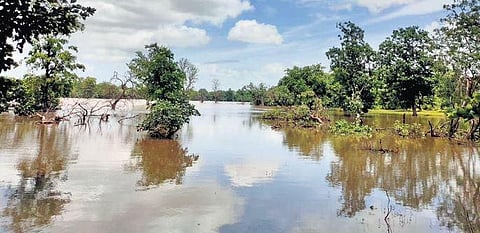
Adilabad is famous for its rich cultivation of cotton. Hence, Adilabad is also referred as "White Gold City" is a great place for nature lovers and for history buffs because it is home to thick forests, cascading waterfalls, a diverse population of fauna and also boasts of a long dynastic past.
Food Crops in Adilabad
NH-44 starts in Telangana on Krishna River Tribuary Tungabhadra River which is a border with Andhrapradesh, crosses Krishna River, Godavari river and ends in Telangana at Godavari Tributary Penganga River which is a border with Maharashtra.
Adilabad railway station (station code: ADB) is located at Adilabad town of Adilabad district, in the Indian state of Telangana. It is under the administration of Nanded railway division of South Central Railway zone.
Telangana End : Mangrool, Bela Mandal, Adilabad district
- Gomutri Vagu joins Penganga River near Gomutri, Tamsi Mandal, Adilabad district, Telangana State, India
- Jella Vagu joins Penganga River near Wadoor, Bheempur Mandal, Adilabad district, Telangana State, India
- Satnala or Sathnala River joins Penganga River near Pendalwada village, Jainad Mandal in Adilabad District, Adilabad district, Telangana State, India
- Mathadi Vagu joins Satnala River near Chanda-T village, Aidilabad Rural Mandal
- Metta Vagu joins Sathnala River, near LindaSangvi Village, Adilabad Mandal
- Nallantiya Vagu joins Penganga River near Kura Village in Jainad Mandal in Adilabad District of Telangana State
- Khuni River joins Penganga on Maharashtra side near Kowtha Village in Mudhole Mandal in Adilabad District
- Khagdur Vagu joins Penganga River near Khagdur and Mangrool village, Bela Mandal, Adilabad district.
Villages benifited: Waddadi, Jamidi, Khapparala, Sawergaon, Bandal Nagapur, Bheemsari, Jamdapur, Chanda(T), Bhoraj, Sirsanna, Mallapur, Goatkuri, Dhimma
(i) Formation of 2.20 km long Earth Bund, with maxiumum height of 17.0 meter
(ii) Construction of 63.25 m long Ogee Spillway and Left Flank Regulator,
(iii) Construction of 13 km long Left Main Canal with CD&CM structures including lining of canal upto 13 km
March 2011 : The project was brought under AIBP during 2006-07 and upto March 2011, irrigation potential of 2024 hectare (5001 acres) is created.
June 1 2013: In case of Mathadi Vagu project, the railway crossing is the only obstacle that had to be tackled as most of the work is complete.Under the project 6,900 acres of land are being irrigated and once the project is completed another 1,600 acres will be irrigated.
Mar 9, 2015 : Two canals—the right and the left—were proposed. They remain incomplete even to this day, resulting in supply of irrigation water only to 5,000 acres.
Gomutri Vagu Project
- Adilabad Dankanapally Sacred Grove
- Adilabad Jainath Sacred Grove
- Adilabad Keslapur Sacred Grove
- Adilabad Kunthala Waterfalls Sacred Grove
- Adilabad Mahagoan Sacred Grove
- Adilabad Narnoor Sacred Grove
- Adilabad Pochara Falls Sacred Grove
- Adilabad Sadalpur Sacred Grove
- Adilabad Sirichelma Sacred Grove
- Adilabad Tangri Madra Sacred Grove
- Adilabad Yekantapur Sacred Grove
The climate of the district is characterized by hot summer and in generally dry except during the south-west monsoon season. The year may be divided into four seasons. The cold season from December to February is followed by the summer season from March to May. The period from june to september constitute the south west monsoon season, while October and November from the post monsoon season .
The rainfall in the district, in general increases from the south-west towards the north east. About 85% of annual rainfall is received during the south-west monsoon season. July being the peak rainy month. The variation in the Annual rainfall from year is not large. The normal Annual rainfall of the district is 1044.5mm .
There is a meterological obervatory, station at headquarters Adilabad. The cold weather commences towards the end of November when the temperature begins to fall rapidly. December is generally the coldest month, with the mean daily maximum temprature at about 29 C and the mininum daily is 15 C .
The relative humidities are high generally during the south-west monsoon season. The air is generally dry during the rest of the year, the district part of the year being the summer season when the humidity in the afternoon is 25% .
During the south-west monsoon season the sky is heavily clouded. There is rapid decrease of cloudings the post-monsoon season. In the rest year the sky is mostly clear of light clouded .
Winds are light to moderate with some strengthening in the period from May to August. During the post-monsoon and cold season, winds blow mostly from the east or north-east. By March, south westerlies and westerlies start blowing and continue during the rest of summer. The sought west monsoon season winds are mostly from directions between south-west and north west
Soil
Red and black soil are both found in Adilabad district though black soil predominates, accounting for almost 72% of the soil in the district. The mineral resources are mainly limestone and manganese ore .
District Composition
Area, Population and Other related characteristics
The district comprises an area of 4,153 square kilometres (1,603 sq mi).with a density of population of 170 persons per sq.km .There are 508 villages exist in Adilabad district.
As per 2011 census, the total population of the district is 7,08,972. It accounts for 2.01 percent of the total population of the state. The male population of the district is 3,56,407 and this forms 50.27% of the district and 2.02 percent of the state male population. Similarly the female population of the district is 3,52,565 and this form 49.73% of the district and 2.02 % of the state female population.
As per the latest 2011 census, the rural population of the district is 541226 which constitutes 76.34% of the district population and 2.52% to total of state rural population. Similarly the urban population of the district spread in 1 town is 1,67,746 constituting 23.66% of the district population at 1.23% of the state urban population.
As per 2011 census, the scheduled caste population of the district is 99,422 which is 14.02 % of the district population and 1.82% of the state scheduled caste population. Similarly the Scheduled Tribe population of the district is 2,24,622 which accounts for 31.68% of the district at 7.06% of the state scheduled tribe population.
The density of population of the district according to 2011 census is 170 persons per sq.km as against 312 persons per sq.km for the state. The literacy rate of the district is 63.46% as against 66.54% of the state literacy rate. The sex ratio of the district is 989 females per 1000 males as against 988 of the state
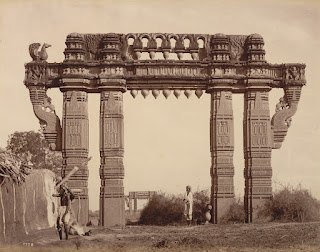
1158 AD - 1323 AD : Kakatiya Dynasty
- Adilabad (urban)
- Adilabad (rural)
- Mavala
- Gudihatnoor
- Bazarhatnoor
- Talamadugu
- Tamsi
- Bela
- Boath
- Jainad
- Ichoda
- Neradigonda
- Sirikonda
- Bheempur
- Indervelly
- Narnoor
- Gadiguda
- Utnoor
Indira Priyadarshini Stadium
Swimming Pool Timings: 5.30 P.M. to 9.30 P.M.
District Sports Authority,
Adilabad - 504 001
Phone: 08742225846
Fax: 08742225848
Mail: dsa.adb@rediffmail.com
The district shares Adilabad parliamentary constituency and has 2 Assembly Constituencies Adilabad
and Boath (ST) of 119 constituencies in Telangana State.
- Control Room Collectorate : 1800-425-1939
- State Control Room : 1070
- Fire : 101
- Medical Help line : 102 /108
- Police: 100
- BSNL Helpline :1503/ 1800-180-1503


