Telangana Tourism, History, Art and Culture with a 360 degree view, covering anything and everything !

Search This Blog

NH 44 (NH 7)

Length      : 3,745.00 kms
Telangana :    512.65 kms
Districts    : Jogulamba Gadwal - Wanaparthy - Mahbubnagar - Rangareddy - Hyderabad - Medchal - Medak - Kamareddy - Nizamabad - Nirmal - Adilabad

National Highway 44 (NH 44), (previously National Highway 7), is the longest-running major north–south National Highway in India. It starts from Srinagar and terminates in Kanyakumari; the highway passes through the states of Jammu & Kashmir, Punjab, Haryana, Delhi, Uttar Pradesh, Madhya Pradesh, Maharashtra, Telangana, Andhra Pradesh, Karnataka, and Tamil Nadu.

NH-44 was laid and is maintained by Central Public Works Department(CPWD).

NH-44 starts on Krishna River Tribuary Tungabhadra River which is a border with Andhrapradesh, crosses Krishna River, Godavari river and ends at Godavari Tributary Penganga River which is a border with Maharashtra.

Jogulamba Gadwal 
Pullur Mahaveer Dham near Tungabhadra River Bridge
Alampur Jogulamba Temple

Wanaparthy
Srirangapuram Sri Ranganayaka Swamy Temple after crossing bridge on Krishna River 
Wanaparthy Palace

Jogulamba Gadwal 
Mahbubnagar
Pillalamarri 

Rangareddy  
Ananthagiri Hills

Hyderabad
Taj Faluknama Palace
Nehru Zoological Park
Mecca Masjid
Golconda Fort
Chowmahalla Palace
Charminar
Salar Jung Museum
Birla Mandir
Hussainsagar Lake
Snow World
St. Mary's Basilica


Kamareddy
Domakonda Fort

Sriramsagar Project on Godavari River


Adilabad
Kuntala Waterfalls
Gayatri Waterfalls
Pochera Waterfalls
Kanakai Waterfalls
Jainath Temple
Dollera, Jainth Mandal Penganaga River border with Maharashtra


Read More

NH 30 (NH 221)

National Highway 30 (NH30 or NH 30)
Total Length : 1,984.3 km (1,233.0 mi)
Length in Telangana : 100.40 kms or 62.4 miles
Start : NH 9 at Sitarganj in Uttarakhand
End : NH 65 at Ibrahimpatnam, Vijayawada in Andhra Pradesh
States : Uttarakhand, Uttar Pradesh, Madhya Pradesh, Chhattisgarh, Telangana and Andhra Pradesh in India.
Start : Bhadrachalam - Palwancha (Bhadradri Kothagudem)
End : Muthagudem (Khammam)
Districts : Bhadradri Kothagudem and Khammam

NH 30 passes through the states of Chhattisgarh, Andhra Pradesh Telangana. Madhya Pradesh Uttar Pradesh and Uttarakhand covering a distance of 2,040 km passing through the cities of Sitarganj, Pilibhit, Bareilly, Shahjahanpur, Sitapur, Lucknow, Raebareli, Allahabad , Rewa, Jabalpur, Raipur, Dhamtari, Keskal, Jagdalpur, Konta, Nellipaka, Bhadrachalam , Tiruvuru and Ibrahimpatnam

NH 30 passes through Bhadrachalam a key town of Pilgrimage importance located in the Bhadradri Kothagudem District of Telangana. The temple town of Bhadrachalam is situated on the banks of Godavari River. The town is synonymous for its famous temple devoted to Lord Rama.

Parnasala is a village in the Dummugudem mandal in the Bhadradri Kothagudem district of
Telangana, India. The village is accessible by road and boats and is situated 32 km from the temple town of Bhadrachalam.

Papikondalu (Papi Hills) takes travellers through a canopy of greens covered by tropical and deciduous rain forests. Silence whispers through the Eastern Ghats of Papikondalu (Papi Hills) as the boat wobbles along the riverbed. An oasis of enchanting beauty and tranquillity, Papikondalu takes travellers through a canopy of greens covered by tropical and deciduous rain forests. Here, one can forget all their worries and just sink in the peaceful arms of nature.

Running through Bhadradri Kothagudem, East Godavari and West Godavari districts, Papikondalu can be reached via the river way through Bhadrachalam and Rajahmundry.
Telangana Tourism boating packages to Papikondalu

Perantalapalli around 2 hours from NH 130 from Bhadrachalam
Perantalapalli, also known as the cloud-laced hill range, is located on the way to Papi Kondalu from Kunavaram. The confluence of the Sabari River and the Godavari River can be seen from this place. 

Perantalapalli is sure to give you the ultimate experience with its picturesque landscapes. Its beauty can be gauged by the fact that it is referred to as cloud-laced hill range. It is located between Kunavaram and Rajahmundry. This tribal village located on hilltop offers view of the confluence of Sabari and Godavari Rivers. View of Papi Hills and Munivaatam Falls are breathtaking.
On NH 30 near Palwancha take Kinnerasani Project Road to reach Kinnerasani Dam and Wildlife Sanctuary. The wildlife sanctuary covers an area of 635.4 square kilometers and this plentiful land serves as the native land for several endangered species. This sanctuary got its name after the river Kinnerasani.


Read More

Nagarkurnool District

Headquarters : Nagarkurnool
Revenue divisions : 3 (Achampet, Kalwakurty and Nagarkurnool)
Mandals : 20
Population : 893,308
Area (km2) : 6,545.00 (2,527.04 sq mi)
Literacy : 53.68%
Highways : NH 167, NH 765, SH 5, SH 18, SH 20, SH 21
Rivers : Krishna, Dindi
Vehicle Registration : TS-31

Nagarkurnool district is one of the 33 districts in the state of Telangana. Nagarkurnool was carved out
of Mahabubnagar district and was made as a district on October 11, 2016. 

It is located on the banks of the River Ganges and is famous for its ghats, temples, and spiritual atmosphere. Khajuraho Temples - These temples are a UNESCO World Heritage Site and are known for their intricate carvings that depict scenes from Hindu mythology.

Nagarkurnool was a district 100 years ago. It was a separate district during the period of 1794-1904. After a railway line was built to Mahabubnagar for the sake of easy transportation district headquarters was moved from Nagarkurnool.

Nagarkurnool is the district headquarters with a population of 42,000.

Nallamalla forest is located in Nagarkurnool district. Nagarjunasagar-Srisailam Tiger Reserve, which is the largest tiger reserve in India, in spread in this district. 

Kalwakurthy is the second largest town in Nagarkurnool district with a population of 66,388. There are three revenue divisions under this district. They are Nagarkurnool, Kalwakurthy and Achampet. 85,000 hectares of forest area is under this district. There are 20 mandals and 362 revenue villages in this district. Achampet and Nagarkurnool Assembly constituencies along with parts of Kalwakurthy and Kollapur constituencies come under this district. 

Tourism
The district is also home to highly popular and truly exotic eco-tourism destination called Somasila, located near Kollapur. 
Ecotourism and Adventure Tourism
Farhabad View Point in Nallamala
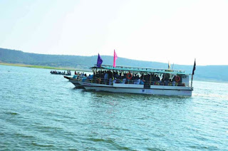
Somasila Boating
There is a boat trip available in Krishna river from Somasila to Srisailam, which will give tourists a wonderful experience.
Sapthanadula Sangamam (confluence of seven rivers) in Somasila
Nallamalla Forest

Religious Tourism
Vattem Venkateshwara Swamy Temple

Mosques
Rangapur Hazrath Niranjan Shah Wali Dargah

Industries
There is cotton industry in Kalwakurthy. 

Irrigation Projects
Kalwakurthy lift irrigation system, Palmuru-Rangareddy lift irrigation system, Srisailam left bank canal tunnel is located in this district. 

Completed
Priyadarshini Jurala Major Irrigation Project located near Revulapally village, Dharur Mandal, Jogulamba Gadwal Dist. to irrigate an ayacut of 102,200 acres (41360 Ha.) under Right Main canal DHARUR,GADWAL, ITIKYALA, MANOPAD mandals of Jogulamba gadwal dist and Left Main Canal in drought prone Mandals of ATMAKUR,KOTAKOTA, PEBBAIR,SRIRANGA PUR, WEEPANGANDLA in Wanaparthy district and Pentlavelli, PANGAL in Nagarkurnool district

Under Construction
Alimineti Madhava Reddy Srisailam Left Bank Canal Project (AMRP) was started in 1983 located in Peddavoora(M), Nalgonda District to irrigate 3 lakh acres annd supplying drinking water to the fluoride affected villages enroute.

Kalwakurthy renamed Mahatma Gandhi LIS Major Irrigation Project located in Regumanigadda of Yellur (V) Kollapur (M) Nagarkurnool district is proposed to provide irrigation water to an extent of 3.40 lakhs acres and drinking water to chronically drought prone upland areas in Mahabubnagar district covering about (303) villages in erstwhile taluks of Kollapur, Nagarkurnool, Achampet, Jadcherla and Kalwakurthy constituencies (in 19 Mandals).

Rajiv Bhima LIS Major Irrigation Project located fore shore of priyadarshini jurala project for Lift-I and foreshore of Ramanpad Reservoir, Ramanpad (V), Atmakur (M), for Lift-II in Wanaparthy District to irrigate 207022 acres in in Makthal, in Mahabubnagar District Atmakur, Wanaparthy in Wanaparthy District and Kollapur Mandal in Nagarkurnool District.

Proposed
Palamuru Rangareddy Lift Irrigation project is a Major Irrigation Project at Karvena village of Bhoothpur, Mahabubnagar district is approved by government and taken up with an estimated cost of Rs.35,250 crore and seeks to irrigate about 10 lakh acres in Mahabubnagar, Ranga Reddy and Nalgonda districts besides providing water for drinking and industrial needs in and around Hyderabad.


Revenue Divisions : 3
  1. Achampet 
  2. Kalwakurthy
  3. Nagarkurnool

Mandals : 20

Nagarkurnool Revenu Division Mandals : 9
  1. Bijinapally 
  2. Nagarkurnool
  3. Peddakothapal ly
  4. Telkapally 
  5. Thimmajipet
  6. Tadoor
  7. Kollapur
  8. Pentlavelli 
  9. Kodair
Kalwakurty Revenu Division Mandals : 5
  1. Kalwakurty
  2. Urkonda
  3. Veldanda 
  4. Vangoor
  5. Charakonda
Achampet Revenu Division Mandals : 6
  1. Achampet 
  2. Amrabad 
  3. Padara
  4. Balmoor
  5. Lingal
  6. Uppununthalanthala


Source
http://www.gloriousindia.com/g/Telangana/Nagarkurnool


Read More

Nallamala Hills

Nallamala Hills located in Telangana and Andhra Pradesh is one of the most soothing hill stations,wrapped in an amazing beauty, shimmering gushing water, deep valleys and thick forests enchants the visitor’s mind and soul.

Pennar and Krishna are two big rivers in this region and Nallamala hills are located between these two rivers. The two big peaks of this hill range are Bhairani at 1100 meters distance from the sea level and Gundla Brahmeswara at 1048 meters level.

For most tourists taking the road to Srisailam, the view of the imposing dam with river Krishna’s waters gushing out of its gates and a darshan of Lord Mallikarjuna Swamy is not enough without a glimpse of dense Nallamala forest in Farahabad.

Read More

Umamaheshwaram Temple

Umamaheswaram also known as Maheshwaram is a temple dedicated to the Hindu god Shiva, located near Rangapur Village, Achampet Mandal, Nagarkurnool District, Telangana India on very tall hills of Nallamala forests showcases a unique Shivalinga with dual color white on one side and red on the other.

The presiding deities in Umamaheshwaram are Mallikarjuna (Shiva) and Bhramaramba (Devi).

Umamaheshwaram Temple is also known as Kubera Sthanam. There are other Temples here of Lord Ganesha, Lord Veerabhadra Swamy, Lord Janardhana Swamy and also that of Lord Nagaraju.

Umamaheswaram, a temple perched in the cliffs of Nallamala, a northern gateway to Srisailam overlooking the vast Deccan plateau. It is a halt and entry to Nallamala on ancient pilgrim trail to Lord Mallikarjuna, deep in the hills.  Sri Giri or Sri Parvati known as Sri Sailam (Sri’s Mountain) which is mentioned in Markandeya Purana (LVII.15), Kumara Purana (30.45-8) and Agni Purina (109). The Padma Purana notes that on the summit of this auspicious and beautiful mountain resides god Mallikarjuna, who is identified as one of the twelve Jyotirlinga's of India, the holy center of Shaivism.

To reach the temple, one has to ride on very steep and dangerous curves of 5 mile length from the bottom of the hill.  Hill ranges shields the temple and 500 metres of stretch to Papa Nasanam. Through the day hardly any sunlight falls on this stretch, thus maintaining the temperature below normal year round. 

Umamaheswaram is popular for its mysterious papanasanam, a small stream that flows beneath the mountain rocks (from the vast maze of roots join flows in rock strata and form springs that emerge at cliffs). The speciality of Papanasanam is that, the stream flows into a small pit and at any given time, you can scoop out a mug of water and the moment you take some water out, it refills itself within seconds ! The belief is, sprinkling this water over you will wash away your sins and also some traditional folk collect it for their medicinal practice.

Traditions as well as epigraphical sources inform us that the inaccessible shrine of Srisailam is approachable through four places on the plains, generally called the gateways of Srisailam on its four-cordinal directions. They are Tripurantakam in the Prakasam district, in the East, Siddhavatam in the Cuddapah district, in the South, Alampuram in the Jogulamba Gadwal district, in the west and Umamahesvaram in the Nagarkurnool district, in the North. 

Umamaheshwaram Sacred grove 
Sacred Groves are small groves that are specific places which are protected and conserved by the local communities as being the sacred residences of local deities and sites for religious and cultural rituals.
The grove is around Shiva temple situated in the middle of the hill surrounded by forests. Near the temple water percolates through the rocks throughout the year and harbours many non flowering plants. It has the richest flora in Nagarkurnool District. About 400 plants were recorded during floristic studies of which about 150 are perennial. Bryophytes like Riccella, Notothallus, Moss, Marchantia, and Pteridophytes, viz Salaginella species, Pteridium spp, Adiantum incisum, Actiniopteris, Petris etc were observed. 

Human interference has started with tea stalls etc too close to the temple adding to pollution. It is an important grove requiring better protection.

Gateways to Srisailam
The concept of the gateways of Srisailam is traceable from 8th -9th centuries AD. All these places, particularly the four main places developed as centers of pilgrimage.

1. TRIPURANTAKAM: The presiding deity here is called Tripurantakadeva, with Goddess Tripurasundaridevi. This place is also called Kumaragiri. Before the construction of Guntur-Guntakal Railway, pilgrims from coastal Andhra used to pass through this place in their journey to Srisailam.If they go by foot they need not go to Dornala. They can directly go from Erragondapalm, Telugurayacheruvu and reach Chukkalaparvatam, climbing which they can reach Srisailam. Now the bus goes through Dornala. Tripurantakama is historically an important place. There are more than a hundred inscriptions incised on the walls and loose stone slabs in the temple compound. Most of these records belong to the medieval period from eleventh to sixteenth century that is from the period of the western Chalukyas to the Kakatiya period. Several local chiefs like the Velanati Chodas, Kota chiefs, and the Kakatiya rulers and their subordinates endowed the temple of Tripurantakadeva with numerous gifts. The Kayastha chiefs were the great worshippers of this God. Ambadeva of that family having revolted against the Kakatiya Queen Rudramadevi, proclaimed independence in A.D. 1289, to which effect he set up a lengthy record in Sanskrit at this temple. The ground plan of the main temple at Tripurantakam is in star shape with a spacious interior garbhagriha and mandapa. It is datable to the early part of the Western Chalukyas. Pasupata Saivism seems to be the main religion that prevailed here for a long period. The Aradhya Saivas came into prominence from fourteenth century.

2. SIDDHHAVATAM: It is a taluk town in the Cuddapah District. The presiding deity here is Jyoti Siddhavatesvara. Jyothi is another holy place very near to this and its god is called Jyothisvara or jyothinath. These two places are on the bank of Pinakini or Penna River. Pilgrims from South visit this place and proceed to Srisailam. We do not find many inscriptions in this temple.

Pushpagiri is also on the bank of the river Pinakini. It is about 12km. from Cuddapah, its district headquarters. The presiding deity here is Vaidyanathasvami. Indranathasvami and Chennakesava are also popularly worshipped here. The antiquity of the place seems to be early as the Ikshvaku period. An inscription at Nagarjunakonda refers to Pushpagiri, where certain Bodhisri is said to have built here a stone pavilion, i.e. silamandapa. The earliest extant epigraphical record at Pushpagiri is datable to the time of the Rashtrakuta king Krishna II (A.D. 878-914) or III (A.D. 939-967). Therein, it is clearly stated that the place is the southern gateway of Srisailam. Inscriptions of other dynasties like the Western Chalukyas, the Kakatiyas, the later Vaidumbas and the Vijayanagara are noticeable here. The main temple here is a double shrine structure for the deities Chennakesava and Umamaheshvara.

3. ALAMPURAM: On the left bank of Tungabhadra in the Jogulmba Gadwal district is the Western gateway of Srisailam. It is also called Halampura in early inscriptions. God Blalabrahmesvara is the presiding deity here. The Goddess Jogulamba, the main female deity here, is considered to be one of the eighteen Sakthis and hence the place is a Saktipitha like Srisailam. There are nine early temples dedicated to nine Brahmesvaras, namely Bala-Brahma, the main deity, Arka-Brahma, Visva-Brahma, Padma-Brahma, Garuda-Brahma, Kumara-Brahma, Vira-Brahma, Svarga-Brahma and Taraka-Brahma. All these temples are early Chalukya structures with uniform curvilinear vimanas, except the sixth one, which is in Dravidian style. The temples are very important study of early temple architecture in the middle Deccan. There are more than fifty inscriptions in these temples, the earliest being that of Chalukya Vikramaditya I (A.D. 657 - 678) and the latest being those of Krishnadevaraya. Of all the four gateways of Srisailam, Alampuram is the richest in ancient structures and epigraphical records. The main school of Saivism that flourished here is kalamukha and later Pasupata. The influence of Siddha cult at Amalapura in the early period is much said in the local tradition.

4. UMAMAHESHVARAM: The Fourth gateway is Umamaheshvaram about 6 km from Achampeta in Nagarkurnool District. It is situated on the edge of a hill forming the vast plateau, generally called Sri Parvata. God Umamaeshara is the presiding deity. Pilgrims from Telangana region in the former days had generally to pass through this temple. The present bus route does not touch this place; it goes two miles away from the temple. According to the inscriptions preserved in the temple the history of the place starts from the Kakatiya period and its references at other places are traceable to the later Chalukya period, from Trailokyamalla Somesvarai I (A.D. 1042 - 68). The Recherla king Madanayaka (1421 AD - 1430 AD) constructed for the benefit of pilgrims a paved footpath with steps from this place up to Jatararevu covering nearly 50 km up to river Krishna. After crossing river at this ferry point known as Jatararevu they have to climb up the Chukkala-parvatam and walk about 4 km to reach Srisailam.

It is in the picturesque Nallamala forest range around 150 kilometers away from Hyderabad on the Hyderabad-Srisailam highway. A festival is held here annually during February and March to celebrate Maha Shivaratri, the Great Night of Shiva.

In the nearby village of Rangapur, one can visit the famous Darga of Niranjanshalvali, where every year on January 17th night, one can stay witness to colossal processions. Lakhs of people partcipate in the procession, making it a colourful affair.

Fifty km from the temple, en route Srisailam, one can see the Mallela Thirtham which houses lord Shiva. The waterfall here is a huge attraction. In order to reach here, one needs to take a diversion from Ottvarla Palli.

Eighty km from here, one can visit Maddimadugu, one more celebrated temple of Lord Anjaneya which experiences thousands of devotees every Saturday and Sunday.

Near the Umamaheshwaram temple, one can have a tour of the world's largest Amarabad Tiger Sanctuary in Mannanur, the Nallamalla forest along the Krishna River. The river cuts through a picturesque gorge of the Nallamala Hills with deep valleys on both sides. The sanctuary, with a wide area of more than 3000 sq. km.

If one wishes to stay back and enjoy even more the surroundings and mysticism of the Umamaheshwaram temple, one has the option for luxurious accommodation in the nearby town of Achampet. If one opts for budget accommodation, the temple has a guesthouse for themselves, next to the temple. One can stay there for a nominal payment of rupees fifty.

Timings : 7:00 AM - 8:30 PM

Contact : +91-1800-425-46464 


Sources
https://tourism.telangana.gov.in/divine-destinations/UmaMaheshwaraSwamy
http://hindutourism.com/11-2-11/srisailam-gateways
Hinduism in Middle India: Narasimha, The Lord of the Middle - Page 92
Lavanya Vemsani 

Read More

Jatprole Temples

Jatprole or Jataprolu in Kollapur Mandal, Nagarkurnool District is popular for two temples known as Madana Gopala Swamy Temple and a group of Shiva temples including the famous Agasthyeswara Swamy.

The temples were moved to Jetprole from the villages of Malleswaram and Manchalakota during the construction of Srisailam.

Madana Gopala Swamy temple, also known as Venu Gopala Swamy temple is dedicated to Lord Krishna. It was built by Rajas of Jetprole during the 16th century.

Lord Sri Krishna who is one of the Ten Incarnations of Lord Vishnu is known as Madana Gopala when he is represented with Rukmini and Satyabhama or otherwise he is known as Venu Gopala Swamy.
Read More

Sri Ranganayaka Swamy Temple

Sri Ranganayaka Swamy Temple is located in Srirangapur,  Pebbair Mandal,  Wanaparthy district, Telangana State, India.

Srirangapuram temple situated at an island formed by 'Ratna Pushkarini' lake and is renowned for the Sri Ranganathaswamy temple. 

There is an interesting story behind this temple. It is said that the King Krishnadevaraya, Vijayanagaram ruler once went to Srirangapuram and was mesmerized by the beauty of Sri Ranganayaka Swamy Temple there. And then he decided to construct a Ranganayaka Swamy Temple in his kingdom. 

Later, Ranganayaka (Lord Vishnu) appeared in his dream and told the king that his idol is lying in the kingdom and an eagle would direct him to that place. And it is said that succeeding day Krishna Devaraya followed the eagle and found the idol between Kothakota and Kanvyapalli mountains. The temple was constructed near Ratna Pushpakarni Lake in the kingdom.
Read More

Kollapur Madhava Swamy Temple

Madhava Swamy temple at Kollapur was built by King Sri Surabhi Madhava Rayalu of the Jetprole Rajas of Jetprole during the 16th century A.D. on the left bank of River Krishna, at Manchalakatta village.

The architecture of the temple is exceedingly beautiful. All around the temple walls the beautifully carved sculptures depict the 24 aspects of Vishnu and the Dasa-Avatars of Vishnu. 

Due to the submergence under the waters of Srisailam Dam, the temple was shifted and transplanted at Kollapur in the year 1989 from Manchalakatta village.

Temple Timings : Morning: 6:00 am to 9:00 am, Evening: 6:00 pm to 8:00 pm

How to Reach
Hyderabad Jedcherla - Nagarkurnool - Kolhapur 182 kms
Kurnool Beechupalli - Nagarala - Kolhapur 113 kms
Mahabubnagar Kothakota - Wanaparthi - Kothapally-Kolhapur 110kms

Kollapur is famous for countless temples. Kollapur region is an area spanning the Nallamala forest
area on the banks of the river Krishna in the Nagarkurnool district, in the state of Telangana India.

The Someshwara, Sangameshwara, and Malleshwara temples are in this region, with traces of architectural treasures from the 2nd century BC. Hundreds of ancient temples are visible in the area, mainly built over 1,500 years ago. 

Due to similar broad roads and surrounding tree plantations, people used to refer to Kollapur as Telangana Mysore (a reference to the larger city of Mysore).


Source
TEMPLES EXPLORERS.
http://www.ghatroads.in/south-india-travel/temples-tourism-info/krishna-left-bank
Read More

Somashila View Point and Boating

Somasila is a temple town that has recently been developed as an eco-tourism project is located in Kollapur Mandal Nagarkurnool district, Telangana State India. It is on the banks of the Krishna River and Somasila reservoir has an island-like appearance and attracts pilgrims round the year.

It is a perfect place for people who love greenery and water. There are water front cottages to stay at Somasila operated by Telangana Tourism.

The place is also a popular religious destination, thanks to 15 temples dedicated to the Hindu deity Shiva. The most famous of them all is the Sri Lalitha Someswara Swamy Temple. The temple complex is where all these temples are located, and all of these 15 temples house a Shivalinga.

Someshwar Swamy Temple (a replica of ancient temple reconstructed as the original place was submerged in reservoir area) a highly revered shrine in Somasila.

There is one more thing that is very big here in Somasila. It’s the festival of Pushkara Snanam where devotees take a dip in the Krishna River, and is considered very auspicious. Here’s the interesting part – the festival is observed once in 12 years!

Backwaters backed up by Srisailam dam has a unique ecosystem with many species of aquatic life, water birds and animals. 

Boating facilities is available at Somasila in the backwaters of Srisailam Dam.

Tourists can view the scenery around from the open deck while travelling in the boat.

Somasila also has beautiful Haritha cottages, for booking of cottages and boating.

With beautiful surroundings and back waters Somasila is an ideal tourist spot to visit. Somasila is at a distance of 172 kms from Hyderabad.

In order to facilitate amenities for tourists, TSTDC is providing accommodation with good landscaping at the site. There is a restaurant with a 40 seating capacity.

Telangana Tourism department has launched Pontoon Boat services, on Krishna river, from Somasila of Kollapur mandal in Nagarkurnool District to Srisailam.

The boat has been named 'Somasila.' The boat will traverse 110 km in five hours, along the Krishna river.
Tourists can view the scenery around from the open deck while travelling in the boat.

The five-hour boat ride is expected to be a memorable one for nature lovers as the river courses its way through hills and valleys exposing tourists to exotic flora and fauna.

TSTDC to offer a road-river-road circuit which promises combination of a long drive, a pilgrimage, a glimpse of the forest and wildlife and a river cruise with lunch on board.

In weekends, the Tourism Corporation is offering Rs 2,800 per head package to tourists. The fee could include breakfast, lunch, dinner and accommodation. Those who want to travel by launch from Somasila are required to pay an additional Rs 600 per head.

The district offers vast scope for water sports development. It is endowed with waterfalls at Singotam and Yelluru. Other tourist attractions in the district include Sangameswara temple, Somasila temple, ancient temples at Jataprolu and Kadilivanam.

The package includes visit to Mallela Teertham waterfalls and Srisailam dam. Two Harita hotels have been set up – one at Jataprolu and the other at Somasila – at a cost of Rs 99 crore. Arrangements for special boating in Somasila are being made.

The bus takes you from Hyderabad on what holds enough promise to be a memorable journey. After crossing the Forest Department check-post at Mannanur, the first stop is at Farahabad, where a breath-taking viewpoint greets you after a few kilometres stretch of dense Nallamala forest. You whip your camera out and take all the pictures you wish, including ‘selfies’ and ‘vidfies’ with a smartphone.

An hour later it is onwards to ‘Mallela Teertham’, the waterfalls bang in the middle of the Nagarjunasagar-Srisailam Tiger Reserve and then the sight imposing, larger-than-life Srisailam dam and the large water spread too, make visitors shoot more photographs.

After a pass-through that affords a glimpse of ‘Paaladhaara and Panchadaara’, two very thin trickles of waterfall from a height, it is time for a darshan of ‘Sakshi Ganapati’.

As one reaches Srisailam, it is time to check into rooms and quickly freshen up before heading out for a darshan of Lord Mallikarjunaswamy before dinner and getting ready for a night’s sleep. On day two, those interested can have a second darshan at the temple, before going down the ropeway to ‘Paatala Ganga’ to board a boat. The five-hour cruise over the waters of the River Krishna has a visit to Akka Maa Devi temple en route and lunch on board before touching Somasila.

At Somasila, there are a couple of rooms at the Haritha Resort run by the TS Tourism Development Corporation (TSTDC) and take in the serene view of the backwaters, apart from also visiting the Someswara Temple. And then its back to business, to work, on a drive that is bound to be with a few regrets.

All this will be a reality within a fortnight and the road-cum-forest-cum-river-road circuit is bound to attract those in the concrete jungle, says TSTDC Chairman Pervaram Ramulu. He goes on to add this could possibly be a one-of-its-kind combination of a long drive, a pilgrimage, a glimpse of the forest and wildlife and a river cruise with lunch on board.

Development of the Hyderabad-Somasila-Srisailam route. Measures to provide amenities on the Hyderabad-Kollapur route are being looked into. Currently, one trip a week is planned. Daily packages will be implemented depending on the tourist arrivals.

Where to Stay
Riverfront Mrugavani SomasilaOnce at the Riverfront Mrugavani Somasila, the focus of attention is on the ring of low meadowed hills with the river waters kissing them on all edges.


Haritha Hotel, SomasilaThe resort is located on the nook of the land which means the river is completely surrounding the resort. Wake up to great views and piping hot filter coffee! This temple town is around four hours from Hyderabad, and we recommend taking a road trip as you'd pass through scenic vistas.

FOR BOOKINGS CONTACT
Phone No +91-6301857270

Note: The Hotel is leased out to private party. Please contact hotel directly for bookings. Hotel Terms and Conditions apply. Please read terms and conditions of the hotel.

Top attractions in the area
Sangameswara Temple in Middle of the Somasila Water Reservoir
Sri Jogulamba Bala Brahmeswara Swamy Temple (Alampur)
Sri Lakshmi Narasimha Swamy Temple (Singotam)
Madhava Swamy Temple (Kollapur)
Sangameswara Temple in Middle of the Somasila Water Reservoir

Kollapur is at a distance of 9 kms from Somasila is also famous for several temples and can be visited together.
9 km from Kollapur
105 km from Mahabubnagar
186 km from Hyderabad


Sources
http://www.telangananewspaper.com/somasila-boats-from-srisailam-of-mahabubnagar-district/
https://www.telanganastateofficial.com/somasila-srisailam-boat-service/
http://etelangana.org/news/news_details/5801
https://tourism.telangana.gov.in/hotels/SomasilaHotel


Read More

Somasila Temple

Sri Lalitha Someswara Swamy temple is a Hindu temple located at banks of Krishna River Somasila village in Nagarkurnool District of Telangana State, India.

It is believed to have been built during the 7th century. Lord Shiva is the presiding deity here. Mahashivaratri and Karthika Pournami are celebrated here with much religious fervor.

The temple was shifted from old Somasila village to higher altitude to protect it from being submerged in Krishna water during the construction of Srisailam Dam.
Read More

SRSP Lakshmi / Laxmi Canal

Lakshmi / Laxmi Canal with a total length of 3.5 km from SRSP (Sri Ram Sagar Project) reservoir to Peddavagu is used to irrigate 8,849 ha (21, 866 acres) of ayacut with a head discharge of 14.12 Cumecs (500 Cusecs) in Nizamabad District

Nizamabad
Sri Ram Sagar Reservoir - Kothapally - Renjarla - Peddavagu (Shetpalle)
Read More

SRSP Saraswati Canal

Saraswati Canal with total length of 144 Kms from Sri Ram Sagar reservoir to Kaddam Narayna 79,000 acres in Nirmal district.
Reddy Reservoir is used to irrigate total ayacut of

Nizamabad
Sri Ram Sagar reservoir - Koutla - Sofinagar - Mukthapur - Narsapur - Babapur

Nirmal
Koratikal  - Chandaram - Danthampalle - Nagapur - AdaviSarangapur - Kaddam Narayna Reddy Reservoir

SRSP (Sri Ram Sagar Project) Stage I
Saraswathi Canal (47 km) to irrigate 14,151 ha (34,967 acres) of ayacut with a head discharge of 42.47 Cumecs (1500 Cusecs) as part

SRSP (Sri Ram Sagar Project) Stage II
 Saraswathi Canal from Km 77 to 144 with modernization of Kadam canal from Km 0.00 to Km 77.00 to benefit total ayacut of 79,000 acres.

It irrigates 79000 acres of ayacut by pumping of 10 TMC feet of water from Yellampalli Barage from 6.5 km to km 77 of Kadem canal

Read More

SRSP Flood Flow Canal

SRSP Flood Flow Canal is a 130 km long gravity canal from Sriram Sagar Project, Sangam Village,
Nizamabad District to Mid Manair Dam, Manwada Village, Karimnagar District, Telangana.

This Canal initiated as part of Sriram Sagar stage-II in which the foundation stone was laid by the former Prime Minister P. V. Narasimha Rao in 1991. With this Canal the surplus water from Sriram Sagar Project can be taken into Mid Manair Dam to utilize another 25 tmcft and also it can be used to fill the Lower Manair Dam at KarimnagarCity.

Canal construction was completed by July 2010, It was open in Aug 2010 after couple of trials. Canal is currently using to fill Lower Manair Dam as Mid Manair is under construction.

It has been designed in such way that it will discharge 22000 cusecs water (Max Capacity), which means it can carry 50 tmcft water into Mid Manair (26 tmcft) and Lower Manair (24 tmcft) reservoirs in just 25 days at its full canal capacity (i.e. 2 tmcft per day).

The flood canal can be used only if the water level is above 1070 feet. The flood canal is not in use in most of the years as the water inflows in to the Sriram Sagar reservoir is not adequate to build up the level to 1070 ft. As an alternative, Yellampalli Lift Canal from Yellampalli Project is under construction with which water will be lifted into Flood Flow Canal at Gangadhara to feed Mid Manair Dam.

In fact, by re-engineering of this defunct canal to reverse its flow direction by raising its bank levels and installing low head high flow concrete volute pumps at existing major aqueducts, at balancing reservoirs & at Sriram Sagar reservoir inlet point, Godavari flood waters during monsoon months from the Pranahita Chevella lift can be stored in the 110 tmcft gross storage capacity of Sriram Sagar reservoir for use during the dry months.[5] The stored water can be released back in to Kakatiya Canal by gravity from the Sriram Sagar reservoir for use in the command area of SRSP as well as Pranahita Chevella projects when adequate water is not available in the lower Godavari basin during dry seasons. Also remodelled SRSP flood canal can be used for supplying water by gravity for irrigating nearly 300,000 acres on both sides of the canal by the water supplied from the Pranahita Chevella project. To facilitate this remodelling in future, the single lift (96 MWC) envisaged from Myadaram tank to the SRSP flood flow canal should be split in to two lifts (76 + 20 MWC) via Kakatiya canal.[6] The re-engineering of this canal is similar to modifications carried out to reverse the water flow of ancient Grand canal under Eastern Route project of South to North Water Transfer in China

Nizamabad
Sriram Sagar Project (Sangam) - Baswapoor - Vempalle - Gandlapet (intersects Peddavagu River) 

Jagtial
Dammannapeta - Nagapur - Errapur - Bandlalingapur - Vittempet -  Metlachittapur - Kathlapur - Thakkallapalle - Rangapur - Rampur - Nookapalle - Muthyampeta
Karimnagar
Burgupalle - Fakeerpet - Garsekurthi - Mulavagu (Vardavelli)
 

https://en.wikipedia.org/wiki/SRSP_Flood_Flow_Canal
Read More

SRSP Kakatiya Canal

Kakatiya Canal is a major canal in the Telangana State in India. Its full name is SRSP Kakatiya Canalas the canal originates from the Sriram Sagar dam to  to the Lower Manair Dam (LMD) Reservoir to Khammam Reservoir

It feeds North Telangana by passing through the region for irrigation and as well as drinking water for major cities.

Kakatiya Canal is about 284 km long with 9,700 cusecs flow capacity and passing through Nizamabad,  Jagtia, Karimnagar, Warangal, Hanumakonda, Mahabubabad.

Suryapeta and Bhadradri Kothagudem Districts will benefited by inflow of Kakatiya Canal to Musi River.

This canal is an inter river basin transfer link by feeding Godavari River water to Krishna river basin in Warangal and Khammam districts. 4 Units of 9 MW each to generate 36 MW have also been set up to harness the water head before feeding water in to the canal.

Located at Km.146.00 of Kakatiya Canal on Manair River near Karimnagar is a balancing reservoir.

Nizamabad
Mendora, Velkatoor, Venchariyal, Yergatla

Jagtial
Dabba - Ibrahimpatnam - Regunta - Metpalli - Vellulla - Masaipeta, Peddapur, Ramarao Palle, Nagulpet, Vallampally, Mediaplli, Thatipally, Ambaripet, Anthargam, Manala, Lambadipalli, Namapur


Karimnagar
Raghampeta - Choppadandi - Konerupalli - Malkapur - Lower Maner Dam - Yadavulapalli - Alugunur - Manakondur - Devampally - Gattu Duddenapally - Narsingapuram - Kareempet - Singapuram - Huzurabad

Mulugu 
 Suraram - Laknavaram - Chinthagattu 

Hanumakonda
Paidipally

Warangal Rural
Mogilicherla - Geesugonda - Sangem - Konkapaka - Yellanda - Wardannapet - Rayaparthy - Muripirala Balancing reservoir - Venkateshwarapally

SRIRAMASAGAR PROJECT STAGE- II  comprises of (i) Extension of Kakatiya Main Canal from KM 284.00 to 346.00 (upto Musi river which joins in Krishna River) near Anantharam, Mahabubabad district.

Mahabubabad 
 Chinnavangara - Pedda Vangara - Narsingapuram Reservoir (Bayyana Vaagu) - Kodakandla


Proposed Kaleshwaram lift irrigation project water will be lifted to Sripada Sagar at Yellampalli in Ramagundam from this project and then it will be conveyed to mid-Manair reservoir.

Kakatiya canal repair work will be undertaken soon on a war footing and a sum of Rs 130 crore has been sanctioned for the purpose, Telangana Irrigation Minister T Harish Rao said today.

After carrying out the repairs, the water from the canal, which has a storage capacity of 8,500 cusec, would be available for irrigation, Rao said.


http://indiatoday.intoday.in/story/kakatiya-canal-repair-work-to-start-soon-telangana-minister/1/504756.html


Read More

Asifabad Peddavagu River

Start : Sirpur (U)-Kerameri hills, Komaram Bheem Asifabad district
End : Murliguda in Bejjur, Komaram Bheem Asifabad discharging into the Pranahita river
Length : 100 km.
Sri Komaram Bheem Project is a Medium Reservoir under construction located at Ada village, Asifabad Mandal, Komaram Bheem Asifabad, District, Telangana.

This Project proposed to supply water to Asifabad, Wankidi, Kaghaznagar, and Sirpur mandals more than 45,000 in acres. But currently, the project is providing irrigation water to about 20,000 acres under its left canal 35 km. Right canal will provide irrigation water to about another 25000 acres.

Peddavagu(Jagannadhapur) is a Medium Irrigation Project under construction near Jagannathpur (V), Kaghaznagar (M), Komaram Bheem Asifabad district. The scheme is intended to irrigate an ayacut of 15,000 acres.

The Sirpur Paper Mills was always accused of releasing effluents into the stream posing threat to cattle and other life forms

The closure of Sirpur Paper Mills (SPM) at Kagaznagar town not only brought a great upheaval in the lives of about 5,000 of its workers and employees, but has also helped reduce water and air pollution in the area to a considerable extent.

Much cleaner water runs in the Peddavagu (large stream) now bringing relief to man and animal in the seven villages of Dahegaon and Bejjur mandals of Komaram Bheem Asifabad district which lie on its banks or close to it.

It used to get polluted at Kagaznagar town where the SPM is located and showed its impact on villages of Chedvai, Bombaiguda, Penchikalpet, Agarguda, Gundepalli, Kammargaon and Nandigam.

The SPM, where paper production started way back in 1942, was always accused of releasing effluents into the stream posing threat to cattle and other life forms. Paper production was suspended at the mill in October last owing to accumulated losses over the years.

Effluents released in the Peddavagu had played havoc in the area until a big hue and cry was raised by villagers following death of cattle over a decade ago. The SPM management did install the effluent treatment plant but there was no stopping of complaints, albeit muted, from villagers about the apparatus not being used.

“Many a time our cattle refused to drink water flowing in the stream. It was obvious that effluents had been released in it,” recalled Kammargaon sarpanch Madapa Srinivas.

The flow of clean water in Peddavagu also signifies a happy augury for the vulture colony resident on the Pala Rapu cliff on the banks of Peddavagu near Nandigam village in Bejjur mandal.

According to villagers scores of the scavenger birds had died in the past owing to consumption of polluted water caused by effluent discharge from the SPM.

The Forest Department, which has launched a vulture conservation programme, will shortly conduct a comparative study of pollution in Peddavagu as it has even samples of water before the SPM was closed.

“The study is essential as pollution can leave a lasting impact on wild animals and birds in the area,” observed Bejjur Forest Range Officer M. Ram Mohan.

Many a time our cattle refused to drink water flowing in the stream. It was obvious that effluents had been released into it.


Source
http://www.thehindu.com/news/national/telangana/peddavagu-flows-cleaner-thanks-to-closure-of-spm/article7166452.ece


Read More
Telangana360.com. Powered by Blogger.

© Telangana360.com, AllRightsReserved.

Designed by ScreenWritersArena